F
Current Radar or Satellite Image

Flhurricane.com - Central Florida Hurricane Center - Tracking Storms since 1995Hurricanes Without the Hype! Since 1995


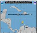
Historic #HurricaneBeryl now in the Caribbean with a day or few left before shear is expected to increase. Elsewhere, Invest 96L is not doing so well.
Days since last H. Landfall - US: Any 306 (Idalia) , Major: 306 (Idalia) Florida - Any: 306 (Idalia) Major: 306 (Idalia)
13.4N 64.0W
Wind: 155MPH
Pres: 938mb
Moving:
Wnw at 21 mph
Click for Storm Spotlight
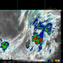
20.2N 97.8W
Wind: 35MPH
Pres: 1007mb
Moving:
Wnw at 7 mph
Click for Storm Spotlight
Invest 96LClick for Invest Information from CIMSS
COMMUNICATION
STORM DATA
CONTENT
FOLLOW US


News Talkback >> 2007 News Talkbacks

typhoon_tip
Meteorologist


Reged:
Posts: 576
Re: Things to Watch
      Thu Jul 19 2007 09:22 PM

Ed and gang,

My feeling is that an Invest should be scheduled sooner rather than later for the TW that is flaring moderate to heavy convection in the NE Caribbean.

Currently, the looping IR with deep layer wind composite layering shows a strong divergent vector field in the 200mb level, expanding, and situated nearly colocated with densest masses of convection. It is likely this is instrumental in giving additional lift and continued propagation of intense shower activity.

I am having trouble finding wind and pressure obs from that part of the Atlantic Basin that are up to the hour, but TPC reports that upwards of 3mb falls have occurred in the last 24 hours, as well as winds veering south over the Leeward Islands; and all this, prior to this evening's preceived intensification of convection. With difluence so strong and on-going deep tropospheric convection intensified [perhaps in nocturnal cyclic forcing], I would not be surprised if surface convegence were getting better defined.

I believe it is worth it, in part, because the Canadian CMC had a rather intense system for several runs [its TC bias aside] and now we have a feature entering that same domain in an atmosphere increasingly more conducive to development. Granted, the 12z had back off a bitl; however, the 12z UKMET hints that it was sniffing something out, as did the GFS, both showing pressure perturbations riding up the eastern flanks of the EC shear axis in the mid level westerlies in roughly concerted timing with the CMC. The 18z GFS continued along this track with a subtle but yet clear pressure perturbation getting pulled north off the East Coast. And, it should be noted that the Global-based models will typically perform poorly until a tropical feature is better developed and in the sounding array at times of model initialization

Point being, given that there was a presence in the models at all, combined with observations this evening, I think it should peg for the GFDL and let her rip.

[Edit: I found this site and it is great! http://www.srh.noaa.gov/sju/caribm.html ]

John

Edited by typhoon_tip (Thu Jul 19 2007 09:35 PM)

Post Extras Print Post   Remind Me!     Notify Moderator


Entire topic
Subject Posted by Posted on
* Things to Watch Ed DunhamAdministrator Thu Jul 19 2007 09:22 PM
. * * Re: One more thing... cieldumort   Sat Jul 28 2007 11:58 AM
. * * Re: One more thing... stormchazer   Sat Jul 28 2007 09:14 AM
. * * Re: One more thing... Storm Hunter   Fri Jul 27 2007 05:39 PM
. * * One more thing... Beach   Fri Jul 27 2007 12:36 PM
. * * Re: Wave at 10n 45w ElizabethH   Fri Jul 27 2007 10:05 AM
. * * Re: Wave at 10n 45w LoisCane   Fri Jul 27 2007 09:55 AM
. * * Wave at 10n 45w Robert   Fri Jul 27 2007 12:23 AM
. * * Re: Things to Watch BLTizzle   Thu Jul 26 2007 02:08 PM
. * * Re: Things to Watch OUSHAWN   Thu Jul 26 2007 09:33 AM
. * * Discussion Excerpts danielwAdministrator   Thu Jul 26 2007 02:55 AM
. * * Re: Things to Watch Storm Hunter   Thu Jul 26 2007 12:18 AM
. * * Re: Things to Watch Storm Cooper   Wed Jul 25 2007 09:40 PM
. * * Re: Things to Watch dem05   Wed Jul 25 2007 09:14 PM
. * * Re: Things to Watch cchsweatherman   Wed Jul 25 2007 05:49 PM
. * * Re: Things to Watch Storm Hunter   Wed Jul 25 2007 05:13 PM
. * * Re: Things to Watch OUSHAWN   Wed Jul 25 2007 02:43 PM
. * * Re: Things to Watch Hurricane29   Wed Jul 25 2007 01:48 PM
. * * Re: Things to Watch Lee-Delray   Wed Jul 25 2007 01:38 PM
. * * Re: Things to Watch Hurricane29   Wed Jul 25 2007 01:29 PM
. * * Re: Things to Watch Lee-Delray   Wed Jul 25 2007 09:50 AM
. * * Re: Things to Watch OUSHAWN   Wed Jul 25 2007 09:12 AM
. * * Re: Things to Watch cieldumort   Sun Jul 22 2007 07:28 PM
. * * Re: Things to Watch Clark   Sun Jul 22 2007 06:32 PM
. * * Re: Things to Watch Hurricane29   Sat Jul 21 2007 05:04 PM
. * * Re: Things to Watch cieldumort   Sat Jul 21 2007 01:51 PM
. * * NHC Getting Hope weatherguy08   Sat Jul 21 2007 11:43 AM
. * * Little Short Term Progress weather_wise911   Fri Jul 20 2007 10:23 PM
. * * Re: Things to Watch typhoon_tip   Fri Jul 20 2007 03:54 PM
. * * Re: Things to Watch LoisCane   Fri Jul 20 2007 10:22 AM
. * * Re: Things to Watch lawgator   Fri Jul 20 2007 10:16 AM
. * * Re: Things to Watch typhoon_tip   Thu Jul 19 2007 11:19 PM
. * * Re: Things to Watch LoisCane   Thu Jul 19 2007 10:40 PM
. * * Re: Things to Watch typhoon_tip   Thu Jul 19 2007 09:27 PM
. * * Re: Things to Watch typhoon_tip   Thu Jul 19 2007 09:22 PM
. * * Re: Things to Watch danielwAdministrator   Thu Jul 19 2007 08:57 PM
. * * Re: Things to Watch Ed DunhamAdministrator   Thu Jul 19 2007 08:50 PM
. * * Re: Things to Watch LoisCane   Thu Jul 19 2007 07:43 PM

Extra information
0 registered and 88 anonymous users are browsing this forum.

Moderator:  


Forum Permissions
      You cannot start new topics
      You cannot reply to topics
      HTML is disabled
      UBBCode is enabled

Rating: *****
Thread views: 25892

Rate this thread

Jump to

Note: This is NOT an official page. It is run by weather hobbyists and should not be used as a replacement for official sources. 
CFHC's main servers are currently located at Hostdime.com in Orlando, FL.
Image Server Network thanks to Mike Potts and Amazon Web Services. If you have static file hosting space that allows dns aliasing contact us to help out! Some Maps Provided by:
Great thanks to all who donated and everyone who uses the site as well. Site designed for 800x600+ resolution
When in doubt, take the word of the National Hurricane Center