F
Current Radar or Satellite Image

Flhurricane.com - Central Florida Hurricane Center - Tracking Storms since 1995Hurricanes Without the Hype! Since 1995


With today's 5PM NHC #HurricaneBeryl update, the U.S. is now officially in the cone for the first time. Jamaica to Mexico to Texas.
Days since last H. Landfall - US: Any 309 (Idalia) , Major: 309 (Idalia) Florida - Any: 309 (Idalia) Major: 309 (Idalia)
19.5N 84.3W
Wind: 110MPH
Pres: 974mb
Moving:
Wnw at 20 mph
Click for Storm Spotlight
Invest 96LClick for Invest Information from CIMSS
COMMUNICATION
STORM DATA
CONTENT
FOLLOW US


General Discussion >> Hurricane Ask/Tell

Valandil
Verified CFHC User


Reged:
Posts: 14
Loc: Hamburg, Germany
Satelite images ???
      Tue Aug 07 2007 06:00 PM

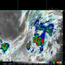
This is more a tecnical question regarding the satelite imegery of today (GOES-EAST : central Atlantic view).

I noticed something on the pictures 15:45 UTC till 16:45 UTC.

In the visible sector there appears to be a bright flash around 67W 10N that wanders to the west till 74W 7N.
In the IR sector it can be seen as a read signature.

I'm suspecting a satelite passby since it seem to be out of focus in the IR sector. Wonder if anybody could confirm this or give a different expanation...

Thanks
Vala

Edited by Valandil (Tue Aug 07 2007 06:08 PM)

Post Extras Print Post   Remind Me!     Notify Moderator


Entire topic
Subject Posted by Posted on
* Satelite images ??? Valandil Tue Aug 07 2007 06:00 PM
. * * Re: Satelite images ??? spinup   Tue Aug 07 2007 10:55 PM

Extra information
0 registered and 24 anonymous users are browsing this forum.

Moderator:  


Forum Permissions
      You cannot start new topics
      You cannot reply to topics
      HTML is disabled
      UBBCode is enabled

Rating:
Thread views: 4204

Rate this thread

Jump to

Note: This is NOT an official page. It is run by weather hobbyists and should not be used as a replacement for official sources. 
CFHC's main servers are currently located at Hostdime.com in Orlando, FL.
Image Server Network thanks to Mike Potts and Amazon Web Services. If you have static file hosting space that allows dns aliasing contact us to help out! Some Maps Provided by:
Great thanks to all who donated and everyone who uses the site as well. Site designed for 800x600+ resolution
When in doubt, take the word of the National Hurricane Center