F
Current Radar or Satellite Image

Flhurricane.com - Central Florida Hurricane Center - Tracking Storms since 1995Hurricanes Without the Hype! Since 1995


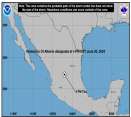
NHC advisories to begin shortly on Storm 01L (Potential Tropical Cyclone 01L) in the Western Gulf. Elsewhere, low east of Bahamas being tracked.
Days since last H. Landfall - US: Any 293 (Idalia) , Major: 293 (Idalia) Florida - Any: 293 (Idalia) Major: 293 (Idalia)
21.3N 93.0W
Wind: 40MPH
Pres: 999mb
Moving:
N at 6 mph
Click for Storm Spotlight
COMMUNICATION
STORM DATA
CONTENT
FOLLOW US


News Talkback >> 2007 News Talkbacks

Clark
Meteorologist


Reged:
Posts: 1710
Re: Two Things to Watch and Flossie
      Sun Aug 12 2007 02:46 AM

Personally, I think this is the start of a very active 4-5 week period with perhaps 8-9 storms through the middle to late part of September. The pieces are indeed all coming together out there -- waters are finally warming up off of the coast of Africa, SAL hasn't been much of a concern of late, shear is being held at bay, and for anything that can get west of 75W, the waters are like bath water. A favorable MJO (or at least upper level divergence) phase looks to be on its way and the wave train coming off of Africa is looking better. There's a lot of truth in what the guy from the HRD said, IMO.

With regards to 90L...

Barring anything unexpected overnight, I think we've passed the stage where something could substantially hinder this from developing in the next couple of days. Convection, while small in extent, is holding together and trying to consolidate near or just west of the center under light to moderate easterly shear. It seems to be just far enough south at 12N to keep from ingesting too much stable air and passing over the cooler SSTs across the region; I still think these factors will tend to hold intensification and organization in check until it gets to 40W, however. I expect we'll see some consolidation during the day on Sunday and probably an upgrade to a depression either late tomorrow or into Monday. NHC will play it conservative for now, I think, as they are well aware of the negative environmental factors still at play.

Expect slow but steady intensification until it nears 50W or so, where some slightly more significant intensification may take place. The GFS output fields have been showing a weak upper low on the north side of the ridge that the cyclone travels to the south of; it looks to be weak enough and far enough away to potentially be more of a help to the storm than a harm in terms of evacuating outflow and the like, but we'll have to watch that. It looks like we'll have a hurricane on our hands by the time it nears the Lesser Antilles in 5-7 days. Just where it impacts them -- or if it slides north of them -- remains to be seen. Any significant northward tug looks like it's going to come from the departing/deamplifying NE trough. Whether it is enough to take the system clear of Puerto Rico and Hispaniola remains to be seen.

From there, confidence is increasing on a potential threat to the SE US -- particularly Florida -- and eventually the Gulf of Mexico, as others have alluded to here. If the system currently in the Caribbean tries to develop, this thinking could be altered, particularly if this disturbance interacts with or is engulfed by the midlatitude flow pattern across the US. Simply put, however, I think that by the time this gets near the Lesser Antilles, we are going to know with a high degree of certainty where this storm is going to go in the 7+ day period beyond that time, just as we have a pretty good handle on the 5-7 day pattern now.

Having said all of that, I'll conclude with two points...
1) This looks to be the most interesting Cape Verde system and potential evolution since the early part of the 2005 season.
2) There are going to be a number of boring days ahead once this system does form...these things are nice to look at, but until you get recon out there, not *that* interesting! Once we get recon out there, though, it's game on.

Oh yeah, and current model plots (image will update as long as it is available as 90L)...


Above link to current model forecast plot...~danielw
Reduced image bicubically to make it still readable, clicking image goes to real link, see post below about animation and mirror~MikeC

Edited by MikeC (Sun Aug 12 2007 04:11 AM)

Post Extras Print Post   Remind Me!     Notify Moderator


Entire topic
Subject Posted by Posted on
* Two Things to Watch and Flossie MikeCAdministrator Sun Aug 12 2007 02:46 AM
. * * Re: Two Things to Watch and Flossie Random Chaos   Mon Aug 13 2007 01:36 PM
. * * Re: Two Things to Watch and Flossie allan   Mon Aug 13 2007 12:45 PM
. * * Re: Two Things to Watch and Flossie madmumbler   Mon Aug 13 2007 11:43 AM
. * * Re: Two Things to Watch and Flossie cieldumort   Mon Aug 13 2007 08:19 AM
. * * Re: Two Things to Watch and Flossie Hugh   Mon Aug 13 2007 02:38 AM
. * * Re: Two Things to Watch and Flossie Random Chaos   Mon Aug 13 2007 02:26 AM
. * * Re: Two Things to Watch and Flossie Old Sailor   Mon Aug 13 2007 02:05 AM
. * * Re: Two Things to Watch and Flossie WeatherNut   Mon Aug 13 2007 02:01 AM
. * * Re: Two Things to Watch and Flossie Random Chaos   Mon Aug 13 2007 01:52 AM
. * * Re: Two Things to Watch and Flossie Storm Hunter   Mon Aug 13 2007 01:24 AM
. * * Re: Two Things to Watch and Flossie weather_wise911   Mon Aug 13 2007 12:54 AM
. * * Re: Two Things to Watch and Flossie nc_tropical_wx79   Mon Aug 13 2007 12:44 AM
. * * Re: Two Things to Watch and Flossie Lee-Delray   Mon Aug 13 2007 12:31 AM
. * * Re: Two Things to Watch and Flossie Storm Cooper   Sun Aug 12 2007 11:42 PM
. * * Re: Two Things to Watch and Flossie hurricaneguy   Sun Aug 12 2007 11:26 PM
. * * Re: Two Things to Watch and Flossie GuppieGrouper   Sun Aug 12 2007 11:19 PM
. * * Re: Two Things to Watch and Flossie Random Chaos   Sun Aug 12 2007 08:29 PM
. * * Re: Two Things to Watch and Flossie MikeCAdministrator   Sun Aug 12 2007 07:42 PM
. * * Re: Two Things to Watch and Flossie Random Chaos   Sun Aug 12 2007 04:44 PM
. * * Re: Two Things to Watch and Flossie MikeCAdministrator   Sun Aug 12 2007 02:59 PM
. * * Re: Two Things to Watch and Flossie Ron Basso   Sun Aug 12 2007 02:46 PM
. * * Re: Two Things to Watch and Flossie MikeCAdministrator   Sun Aug 12 2007 01:07 PM
. * * Re: Two Things to Watch and Flossie Steve   Sun Aug 12 2007 12:36 PM
. * * Re: Two Things to Watch and Flossie Storm Hunter   Sun Aug 12 2007 06:12 AM
. * * Re: Two Things to Watch and Flossie MikeCAdministrator   Sun Aug 12 2007 03:45 AM
. * * Re: Two Things to Watch and Flossie West FL Jess   Sun Aug 12 2007 02:48 AM
. * * Re: Two Things to Watch and Flossie Clark   Sun Aug 12 2007 02:46 AM
. * * Re: Two Things to Watch and Flossie Storm Hunter   Sun Aug 12 2007 01:42 AM
. * * Re: Two Things to Watch and Flossie Beaumont, TX   Sun Aug 12 2007 01:30 AM
. * * Re: Two Things to Watch and Flossie Old Sailor   Sun Aug 12 2007 01:16 AM
. * * Re: Two Things to Watch and Flossie HCW   Sat Aug 11 2007 08:48 PM
. * * Re: Two Things to Watch and Flossie stormchazer   Sat Aug 11 2007 08:47 PM

Extra information
0 registered and 53 anonymous users are browsing this forum.

Moderator:  


Forum Permissions
      You cannot start new topics
      You cannot reply to topics
      HTML is disabled
      UBBCode is enabled

Rating: *****
Thread views: 14812

Rate this thread

Jump to

Note: This is NOT an official page. It is run by weather hobbyists and should not be used as a replacement for official sources. 
CFHC's main servers are currently located at Hostdime.com in Orlando, FL.
Image Server Network thanks to Mike Potts and Amazon Web Services. If you have static file hosting space that allows dns aliasing contact us to help out! Some Maps Provided by:
Great thanks to all who donated and everyone who uses the site as well. Site designed for 800x600+ resolution
When in doubt, take the word of the National Hurricane Center