F
Current Radar or Satellite Image

Flhurricane.com - Central Florida Hurricane Center - Tracking Storms since 1995Hurricanes Without the Hype! Since 1995


#93L now a small better defined circulation with deep convection set to come ashore N of Tampico, MX. Recon investigating. Still 40% odds.
Days since last H. Landfall - US: Any 299 (Idalia) , Major: 299 (Idalia) Florida - Any: 299 (Idalia) Major: 299 (Idalia)


News Talkback >> 2007 News Talkbacks

cieldumort
Moderator


Reged:
Posts: 2321
Loc: Austin, Tx
Re: Winding Down
      Tue Nov 06 2007 03:09 AM

Herbert-Poteat technique as applied by SAB just logged in another 2.5/2.5 as of 0545Z. However, I think that while under "normal" circumstances a CI of 2.5 would support subtropical (or tropical) storm intensity (and indeed 92L is likely blowing at or above 35 knots) the application of this technique to 92L simply does not necessarily necessitate the naming of the system yet, as it is arguably still largely a non-tropical gale, and not quite a "standard-enough" subtropical cyclone. For one, it appears to have been overly cold-cored throughout its depth.

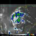
Shear over 92L seems to be running an average of 25 knots tonight, plus or minus, which is usually a touch strong for a deeply-stacked non-tropical cyclone to have an easy transition. Higher shear to the west of the center, and lighter shear from the center - east. Convection is certainly healthier to the east. What -could- happen, given that SSTs are generally supportive of more significant subtropical and perhaps even tropical development, would be for the convection currently displaced to the east to keep firing up, further moistening up the atmosphere over the rest of the cyclone and allowing for some more efficient thunderstorm formation to occur, while maybe - and this part would be critical for any real tropical development - maybe creating high pressure aloft. If one or both of these were to happen, then I can see convection closer to, or even within the very center, improving, which would be far more likely to do the trick for 92L before the clock runs out on it.

All of those qualifiers aside, it is very interesting to note that this feature, and the environment it is in, has CIRA's Tropical Cyclone Formation Probability Product hitting its season peak to-date for TC formation probability in the Subtropical Atlantic. Significantly higher probabilities than when Jerry formed, even.

Post Extras Print Post   Remind Me!     Notify Moderator


Entire topic
Subject Posted by Posted on
* Winding Down Ed DunhamAdministrator Tue Nov 06 2007 03:09 AM
. * * Re: late entry? cchsweatherman   Sun Dec 09 2007 04:54 PM
. * * Re: late entry? cieldumort   Sun Dec 09 2007 02:27 AM
. * * late entry? HanKFranK   Sat Dec 08 2007 10:39 PM
. * * Re: Winding Down cieldumort   Sat Dec 01 2007 03:56 PM
. * * Re: Winding Down Rabbit   Sat Dec 01 2007 01:48 PM
. * * Re: Winding Down saluki   Sat Dec 01 2007 11:19 AM
. * * Re: Winding Down Lee-Delray   Tue Nov 27 2007 01:41 PM
. * * Re: Winding Down cieldumort   Sun Nov 11 2007 02:26 AM
. * * Re: Winding Down cieldumort   Fri Nov 09 2007 02:41 PM
. * * Re: Winding Down cieldumort   Wed Nov 07 2007 03:46 PM
. * * Re: Winding Down Storm Hobbyist   Tue Nov 06 2007 08:09 AM
. * * Re: Winding Down cieldumort   Tue Nov 06 2007 03:09 AM
. * * Re: Winding Down allan   Mon Nov 05 2007 11:37 PM
. * * Re: Winding Down Old Sailor   Mon Nov 05 2007 10:38 PM

Extra information
0 registered and 59 anonymous users are browsing this forum.

Moderator:  


Forum Permissions
      You cannot start new topics
      You cannot reply to topics
      HTML is disabled
      UBBCode is enabled

Rating: *****
Thread views: 17309

Rate this thread

Jump to

Note: This is NOT an official page. It is run by weather hobbyists and should not be used as a replacement for official sources. 
CFHC's main servers are currently located at Hostdime.com in Orlando, FL.
Image Server Network thanks to Mike Potts and Amazon Web Services. If you have static file hosting space that allows dns aliasing contact us to help out! Some Maps Provided by:
Great thanks to all who donated and everyone who uses the site as well. Site designed for 800x600+ resolution
When in doubt, take the word of the National Hurricane Center