cieldumort
Moderator

Reged:
Posts: 2434
Loc: Austin, Tx
|
 Re: 2550SM East of Central Florida
Mon Dec 31 2007 10:56 AM
|
|
|
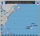
Yeah, I'm in the could-have/should-have camp, myself. The remaining hint of a decaying post-frontal trof left connected to 95L is splitting hairs, and I think essentially arguing over unnecessary minutia. The vast majority of the features of this cyclone have been consistent with a short-lived subtropical storm even briefly attempting to become tropical before starting a bit of extra-tropical transition, and now has been left meandering as a 45 knot 1004mb "remnant low" (as of this morning) while in the process of spinning down, most probably.
For a feature that went without a name, 95L, whatever NHC ultimately chooses to do with it post-season, has had far more "Special Feature" write-ups in the TWDs than any non-named system I can think of in recent memory. Additionally, the few STDSs which were issued have covered several days now.
Given the above, and also that a couple of the scat passes suggested winds could have easily been in the 40-50 knot range for a few cycles worth of time, plus a solid run of satellite-based interpretations of subtropical storm intensity, and considering everything in this most recent TWD I quote below, I think there is plenty of ammunition for those who believe it should be added in post-season to argue the case.
...SPECIAL FEATURE...
A LARGE LOW PRES SYSTEM IS LOCATED ABOUT 850 NM SW OF THE AZORES
NEAR 26N36W. A FORTUITOUS REPORT FROM DRIFTING BUOY 62901 AT 00Z
REPORTED A PRES OF 1004.6 MB VERY NEAR THE LOW-LEVEL
CENTER...ACCORDINGLY THE MIN PRES WAS DROPPED TO 1004 MB.
HOWEVER...THE OVERALL CLOUD PATTERN HAS DETERIORATED SINCE THAT
TIME SO IT IS POSSIBLE THAT THE PRES MAY HAVE INCREASED
SLIGHTLY. EARLIER THIS MORNING...CONVECTION WAS MOST ORGANIZED
IN THE NW QUADRANT AND WAS GENERALLY MODERATE IN NATURE...CLOUD
TOPS NEAR -60 C...ACROSS THE QUADRANT. THIS CONVECTION HAS NOW
ROTATED TO THE SW QUADRANT AND HAS GENERALLY DECREASED IN AERIAL
COVERAGE AS MODERATE CONVECTION IS CONFINED FROM 25N-27N BETWEEN
37W-39W. AN ASCAT PASS AROUND 00Z REVEALED A FEW 45 KT WIND
VECTORS NEAR THE SWATH EDGE IN THE NW SEMICIRCLE...WHERE THE
PRESSURE GRADIENT IS TIGHTEST DUE TO HIGH PRES CENTERED TO THE
NW. AT ABOUT THE SAME TIME...A VERY CONVENIENT JASON ALTIMETER
PASS CROSSED THE CIRCULATION REPORTING MAX SEAS NEAR 26 FT AND A
300 NM 12 FT SEA RADII N OF THE CENTER. MORE RECENTLY...A QSCAT
PASS AROUND 0830Z SHOWED A FEW BELIEVABLE 40 KT WIND VECTORS W
OF THE CENTER.
|
|


 Flat
Flat


