F
Current Radar or Satellite Image

Flhurricane.com - Central Florida Hurricane Center - Tracking Storms since 1995Hurricanes Without the Hype! Since 1995


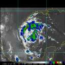
#93L now a small better defined circulation with deep convection set to come ashore N of Tampico, MX. Recon investigating. Still 40% odds.
Days since last H. Landfall - US: Any 299 (Idalia) , Major: 299 (Idalia) Florida - Any: 299 (Idalia) Major: 299 (Idalia)


News Talkback >> 2008 News Talkbacks

typhoon_tip
Meteorologist


Reged:
Posts: 576
Re: Cristobal Out to Sea, Dolly in Gulf, Questions
      Mon Jul 21 2008 01:01 PM

Quote:

Since I got a few emails about this this morning.... Things may change pretty quickly with Dolly, so just wanted to put up a reminder to keep watch, especially through the afternoon. Although the westerly track is more likely, if Dolly does get organized and gains strength then northerly is definitely possible as well.

Dvorak T Numbers are around 3.0, so it is doing pretty well convection wise right now. If recon finds evidence of a Low Level Circulation then those numbers will be important.

Everyone in that forecast cone needs to be watching this system.


Right now Dolly is being guided swiftly along by a ridge axis over the SE U.S. However, most global numerical models predict the influence of this large scale synoptic feature to wane enough to weaken the steering field substantially. This should induce a slowing of the forward speed beginning at ~ 60 hours.

It should be noted that in addition to slowing...a few of the overnight track guidance have shifted substantially north of the previous runs. The 06z GFDL and HWRF, for example, take Dolly to over 90kts and bring her ashore in the TX Bend area...perhaps missing Mexico altogether in these solutions. While such details are far from certain, you do bring up a good point that might be a harbinger, relating to a stronger system having more polar-ward ascent. Overnight...as we noted by a number of posters and apparently confirmed, Dolly did a center jump, such that much of her circulation managed to stay over water...not encountering the deleterious effects of land. This asserts a stronger ramp up curve (potentially), but more importantly, most of the past guidance was based on a weaker system that passed more bodily over the Peninsula. Since that did not take place, the 12z runs will be more telling.

There is a con and a pro at the moment, to faster intensification:
A broad circumavallate requires a longer duration to concentrate a core;
In about 1 day, Dolly will be moving headlong across a very rich oceanic heat content, where the thermocline extends quite deep...indicating more than the usual heat content (we saw what Katrina did when she passed over such feature in the eastern Gulf).

..Because the overall environment has recently gone from marginal/shear, to very little shear with an upper level anticyclone sprawling all the western Gulf, I'm going to go ahead assume the upper ends of the intensity spectrum will be achieved. Part of this decision is also based on tropical cyclones, once garnered enough momentum, tend to exceed guidance better than 50% of the time. Since (finally) a real central axis to the circulation is definable (hi res visible imagery), she's developing an inner core and it appear that threshold is nearing. I like the NHC's idea to go a bit aggressive, while perhaps conserving a little do to Dolly's large size.

Edited by typhoon_tip (Mon Jul 21 2008 01:03 PM)

Post Extras Print Post   Remind Me!     Notify Moderator


Entire topic
Subject Posted by Posted on
* Dolly Strengthening.. Hurricane Warnings Up in Texas Brownsville to Corpus Christi MikeCAdministrator Mon Jul 21 2008 01:01 PM
. * * Re: Dolly Strengthening.. Hurricane Warnings Up in Texas Brownsville to Corpus Christi Storm Hunter   Tue Jul 22 2008 05:05 PM
. * * Re: Dolly Strengthening.. Hurricane Warnings Up in Texas Brownsville to Corpus Christi ShanaTX   Tue Jul 22 2008 05:00 PM
. * * Re: Dolly Strengthening.. Hurricane Warnings Up in Texas Brownsville to Port O'Connor typhoon_tip   Tue Jul 22 2008 04:35 PM
. * * Re: Dolly Strengthening.. Hurricane Warnings Up in Texas Brownsville to Port O'Connor Storm Hunter   Tue Jul 22 2008 04:24 PM
. * * Re: Dolly Strengthening.. Hurricane Warnings Up in Texas Brownsville to Port O'Connor Clark   Tue Jul 22 2008 03:58 PM
. * * Re: Dolly Strengthening.. Hurricane Warnings Up in Texas Brownsville to Port O'Connor scottsvb   Tue Jul 22 2008 03:23 PM
. * * Re: Dolly Strengthening.. Hurricane Warnings Up in Texas Brownsville to Port O'Connor Beaumont, TX   Tue Jul 22 2008 03:11 PM
. * * Re: Dolly Strengthening.. Hurricane Warnings Up in Texas Brownsville to Port O'Connor WeatherNut   Tue Jul 22 2008 03:03 PM
. * * Re: Dolly Strengthening.. Hurricane Warnings Up in Texas Brownsville to Port O'Connor MikeCAdministrator   Tue Jul 22 2008 01:40 PM
. * * Re: Dolly Strengthening.. Hurricane Warnings Up in Texas Brownsville to Port O'Connor Rich B   Tue Jul 22 2008 01:06 PM
. * * Re: Dolly Strengthening.. Hurricane Warnings Up in Texas Brownsville to Port O'Connor WeatherNut   Tue Jul 22 2008 11:05 AM
. * * Re: Dolly Strengthening.. Hurricane Warnings Up in Texas Brownsville to Port O'Connor cieldumort   Tue Jul 22 2008 10:04 AM
. * * Re: Dolly Strengthening.. Hurricane Warnings Up in Texas Brownsville to Port O'Connor MikeCAdministrator   Tue Jul 22 2008 08:58 AM
. * * Re: Dolly Strengthening.. Hurricane Warnings Up in Texas Brownsville to Port O'Connor berrywr   Tue Jul 22 2008 08:55 AM
. * * Re: Hurricane Warnings Up in Texas Brownsville to Port O'Connor Random Chaos   Tue Jul 22 2008 07:52 AM
. * * Re: Hurricane Warnings Up in Texas Brownsville to Port O'Connor cieldumort   Tue Jul 22 2008 04:35 AM
. * * Re: HDOB Wind Speeds Storm Hunter   Tue Jul 22 2008 01:41 AM
. * * Re: HDOB Wind Speeds Storm Hunter   Tue Jul 22 2008 01:38 AM
. * * Re: HDOB Wind Speeds Storm Hunter   Tue Jul 22 2008 01:27 AM
. * * Re: HDOB Wind Speeds typhoon_tip   Tue Jul 22 2008 12:39 AM
. * * Re: HDOB Wind Speeds cieldumort   Mon Jul 21 2008 11:47 PM
. * * Re: HDOB Wind Speeds scottsvb   Mon Jul 21 2008 11:35 PM
. * * Warnings are UP danielwAdministrator   Mon Jul 21 2008 11:32 PM
. * * HDOB Wind Speeds danielwAdministrator   Mon Jul 21 2008 11:21 PM
. * * Re: Hurricane Watches Up in Texas Brownsville to Port O'Connor cieldumort   Mon Jul 21 2008 10:37 PM
. * * Re: Recon WeatherNut   Mon Jul 21 2008 10:34 PM
. * * Re: Recon LoisCane   Mon Jul 21 2008 10:29 PM
. * * Re: Recon WeatherNut   Mon Jul 21 2008 10:13 PM
. * * Re: Recon Storm Hunter   Mon Jul 21 2008 07:09 PM
. * * Re: Recon MikeCAdministrator   Mon Jul 21 2008 07:02 PM
. * * Re: Recon Storm Hunter   Mon Jul 21 2008 06:49 PM
. * * Re: Recon Storm Hunter   Mon Jul 21 2008 06:15 PM
. * * Recon danielwAdministrator   Mon Jul 21 2008 04:33 PM
. * * DOL and LY danielwAdministrator   Mon Jul 21 2008 04:24 PM
. * * Re: Cristobal Out to Sea, Dolly in Gulf, Questions Storm Hunter   Mon Jul 21 2008 03:28 PM
. * * Re: Cristobal Out to Sea, Dolly in Gulf, Questions MikeCAdministrator   Mon Jul 21 2008 02:35 PM
. * * Re: Cristobal Out to Sea, Dolly in Gulf, Questions typhoon_tip   Mon Jul 21 2008 02:24 PM
. * * Re: Cristobal Out to Sea, Dolly in Gulf, Questions danielwAdministrator   Mon Jul 21 2008 02:16 PM
. * * Re: Cristobal Out to Sea, Dolly in Gulf, Questions typhoon_tip   Mon Jul 21 2008 01:01 PM
. * * Re: Cristobal Out to Sea, Dolly in Gulf, Questions cieldumort   Mon Jul 21 2008 10:58 AM
. * * Re: Cristobal Out to Sea, Dolly in Gulf, Questions MikeCAdministrator   Mon Jul 21 2008 10:40 AM
. * * Re: Cristobal Out to Sea, Dolly in Gulf, Questions craigm   Mon Jul 21 2008 10:04 AM
. * * Re: Cristobal Out to Sea, Dolly in Gulf, Questions MikeCAdministrator   Mon Jul 21 2008 09:28 AM

Extra information
0 registered and 325 anonymous users are browsing this forum.

Moderator:  


Forum Permissions
      You cannot start new topics
      You cannot reply to topics
      HTML is disabled
      UBBCode is enabled

Rating: *****
Thread views: 23702

Rate this thread

Jump to

Note: This is NOT an official page. It is run by weather hobbyists and should not be used as a replacement for official sources. 
CFHC's main servers are currently located at Hostdime.com in Orlando, FL.
Image Server Network thanks to Mike Potts and Amazon Web Services. If you have static file hosting space that allows dns aliasing contact us to help out! Some Maps Provided by:
Great thanks to all who donated and everyone who uses the site as well. Site designed for 800x600+ resolution
When in doubt, take the word of the National Hurricane Center