F
Current Radar or Satellite Image

Flhurricane.com - Central Florida Hurricane Center - Tracking Storms since 1995Hurricanes Without the Hype! Since 1995


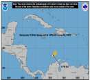
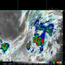
Historic #HurricaneBeryl now in the Caribbean with a day or few left before shear is expected to increase. Elsewhere, Invest 96L is not doing so well.
Days since last H. Landfall - US: Any 306 (Idalia) , Major: 306 (Idalia) Florida - Any: 306 (Idalia) Major: 306 (Idalia)
12.4N 61.3W
Wind: 140MPH
Pres: 956mb
Moving:
Wnw at 20 mph
Click for Storm Spotlight
20.2N 97.8W
Wind: 35MPH
Pres: 1007mb
Moving:
Wnw at 7 mph
Click for Storm Spotlight
Invest 96LClick for Invest Information from CIMSS
COMMUNICATION
STORM DATA
CONTENT
FOLLOW US


News Talkback >> 2008 News Talkbacks

cieldumort
Moderator


Reged:
Posts: 2339
Loc: Austin, Tx
Re: Wave Watching
      Wed Jul 30 2008 03:19 AM

It's pretty clear tonight that 98L has been developing at a good clip, so far
- and to no surprise, already yanking northbound.

Lacking any ship or buoy reports, the nearest stations are land-based. Pressures a good bit easterly of 98's coc have already been down to 1007mb, with sustained winds from the southwest, south, southeast, east-southeast and southeast in a range of 10-25mph... (Inland, and a jump east of the center.)

Combined with the latest Dvorak estimates, it's easy to argue that an upgrade could be on the way this morning, should convection stay healthy. Here are the latest from SAB, which some may think the most recent two look a little conservative:

30/0600 UTC 14.4N 18.8W T1.5/1.5 98L -- Atlantic Ocean
30/0000 UTC 13.4N 17.6W T1.0/1.0 98L -- Atlantic Ocean
30/0000 UTC 13.4N 17.6W TOO WEAK INVEST -- Atlantic Ocean
29/1730 UTC 12.2N 16.9W TOO WEAK INVEST -- Atlantic Ocean
29/1200 UTC 11.3N 16.6W TOO WEAK INVEST -- Atlantic Ocean

98L has been on a solid NNW course -
to be expected of a more developed feature.

Early model support for 98L is almost flat. So far, they all are starting with a weaker feature than has existed. Thinking a few more microwave passes, and hopefully a solid scat or two, everything else being equal, especially convective-wise, daylight may very well seal the deal for NHC, and perhaps then we should be able to start getting some model runs on it worth considering. Given the rapid ramp-up and NNWD track so far, it might be only one for the CVs to worry about. Regardless, lots and lots of blue between there and over here...

Waiting for daylight...

Post Extras Print Post   Remind Me!     Notify Moderator


Entire topic
Subject Posted by Posted on
* Gulf of Mexico Watching and Wave Watching Ed DunhamAdministrator Wed Jul 30 2008 03:19 AM
. * * Re: Gulf of Mexico Watching and Wave Watching Random Chaos   Sun Aug 03 2008 04:25 PM
. * * Re: Gulf of Mexico Watching and Wave Watching cieldumort   Sun Aug 03 2008 04:03 PM
. * * Administrative Note Ed DunhamAdministrator   Sun Aug 03 2008 04:02 PM
. * * Re: GOM 91L Storm Hunter   Sun Aug 03 2008 01:06 PM
. * * GOM 91L danielwAdministrator   Sat Aug 02 2008 10:18 PM
. * * Re: Wave Watching Storm Hunter   Sat Aug 02 2008 08:42 PM
. * * Re: Wave Watching Black Pearl   Sat Aug 02 2008 07:43 PM
. * * Re: Wave Watching xxflcyclonexx   Sat Aug 02 2008 04:02 PM
. * * Re: Wave Watching Storm Hunter   Sat Aug 02 2008 01:57 PM
. * * Re: Wave Watching Hurricane29   Sat Aug 02 2008 01:57 PM
. * * Re: Wave Watching weathernet   Sat Aug 02 2008 01:15 PM
. * * Northern GOM danielwAdministrator   Sat Aug 02 2008 12:52 PM
. * * Re: Wave Watching cieldumort   Sat Aug 02 2008 10:49 AM
. * * Re: Wave & 90L Watching weathernet   Sat Aug 02 2008 09:39 AM
. * * Re: Wave Watching cieldumort   Fri Aug 01 2008 10:12 PM
. * * Re: Wave Watching craigm   Fri Aug 01 2008 04:27 PM
. * * Re: Wave Watching doug   Fri Aug 01 2008 12:25 PM
. * * Re: Wave Watching cieldumort   Fri Aug 01 2008 12:24 PM
. * * Re: Wave Watching metwannabe   Fri Aug 01 2008 09:09 AM
. * * Re: Wave Watching metwannabe   Fri Aug 01 2008 09:05 AM
. * * Re: Wave Watching cieldumort   Wed Jul 30 2008 09:51 PM
. * * Re: Wave Watching metwannabe   Wed Jul 30 2008 08:29 PM
. * * Re: 98L cieldumort   Wed Jul 30 2008 01:19 PM
. * * 98L danielwAdministrator   Wed Jul 30 2008 12:53 PM
. * * Re: Wave Watching cieldumort   Wed Jul 30 2008 03:19 AM
. * * 98L Invest? ltpat228   Tue Jul 29 2008 10:52 PM
. * * Re: Wave Watching cieldumort   Tue Jul 29 2008 09:41 PM
. * * Re: Wave Watching M.A.   Tue Jul 29 2008 05:50 PM
. * * Re: Wave Watching cieldumort   Tue Jul 29 2008 10:56 AM
. * * Re: GOM Ed in Va   Tue Jul 29 2008 08:25 AM
. * * Re: GOM WeatherNut   Mon Jul 28 2008 07:09 PM
. * * Re: GOM cieldumort   Mon Jul 28 2008 04:20 PM
. * * Re: Wave Watching scottsvb   Mon Jul 28 2008 02:12 PM
. * * GOM danielwAdministrator   Mon Jul 28 2008 01:50 PM
. * * Re: Wave Watching danielwAdministrator   Mon Jul 28 2008 01:24 PM
. * * Re: Wave Watching scottsvb   Mon Jul 28 2008 11:19 AM
. * * Re: Wave Watching LoisCane   Mon Jul 28 2008 08:12 AM
. * * Re: Wave Watching LoisCane   Sun Jul 27 2008 04:37 PM
. * * Re: Wave Watching craigm   Sun Jul 27 2008 12:04 PM
. * * Re: Wave Watching Hurricane29   Sat Jul 26 2008 12:48 PM

Extra information
0 registered and 122 anonymous users are browsing this forum.

Moderator:  


Forum Permissions
      You cannot start new topics
      You cannot reply to topics
      HTML is disabled
      UBBCode is enabled

Rating: *****
Thread views: 22847

Rate this thread

Jump to

Note: This is NOT an official page. It is run by weather hobbyists and should not be used as a replacement for official sources. 
CFHC's main servers are currently located at Hostdime.com in Orlando, FL.
Image Server Network thanks to Mike Potts and Amazon Web Services. If you have static file hosting space that allows dns aliasing contact us to help out! Some Maps Provided by:
Great thanks to all who donated and everyone who uses the site as well. Site designed for 800x600+ resolution
When in doubt, take the word of the National Hurricane Center