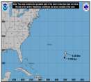
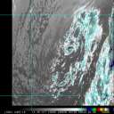
Rafael continues to decouple over the Gulf. Meanwhile we are keeping a watch on Invest 98L around the Bahamas and potentially a new low forming in the Caribbean.
Days since last H. Landfall - US: Any
31 (Milton)
, Major:
31 (Milton)
Florida - Any: 31 (Milton)
Major:
31 (Milton)
Quote: I predict a Naples landfall as a minimal Cat 1 around 5AM tomorrow.
TROPICAL STORM FAY ADVISORY NUMBER 15 NWS TPC/NATIONAL HURRICANE CENTER MIAMI FL AL062008 500 AM EDT TUE AUG 19 2008
...FAY MAKING LANDFALL AT CAPE ROMANO... MAXIMUM SUSTAINED WINDS ARE NEAR 60 MPH
I was off by 20 miles and 15 mph, but got the timing just right. Looks like she sucked in too much dry air after that last flurry of convection in Florida Bay and thus never made hurricane status. After seeing only 50 mph winds in the Keys I knew the NHC forecast of Cat 1 wasn't likely. Also should have remembered that Marco Island sticks out into the Gulf and given Fay's track she would hit there BEFORE Naples.
I give the NHC a "B" on this one, considering how sloppy Fay was, with the center constantly relocating and the lack of access to Cuban air space they did a really good job. A touch too aggressive with the strength (which they tend to do as a CYA) and too far NW on the track up until the last 12 hours.
-------------------- South FL Native... experienced many tropical systems, put up the panels for: David 79 - Floyd 87 - Andrew 92 - Georges 98 - Frances 04 - Wilma 05 - Matthew 16 - Irma 17
Lost our St James City rental property to Ian 22
0 registered and 3 anonymous users are browsing this forum.
Moderator:
Forum Permissions
You cannot start new topics
You cannot reply to topics
HTML is disabled
UBBCode is enabled
Rating:
Thread views: 116632
Note: This is NOT an official page. It is run by weather hobbyists and should not be used as a replacement for official sources.
CFHC's main servers are currently located at Hostdime.com in Orlando, FL.
Image Server Network thanks to Mike Potts and Amazon Web Services. If you have static file hosting space that allows dns aliasing contact us to help out! Some Maps Provided by:
Great thanks to all who donated and everyone who uses the site as well.
Site designed for 800x600+ resolution
When in doubt, take the word of the National Hurricane Center