F
Current Radar or Satellite Image

Flhurricane.com - Central Florida Hurricane Center - Tracking Storms since 1995Hurricanes Without the Hype! Since 1995


First day of the Atlantic Hurricane season, no tropical activity on the horizon in the near term. Mid August is usually when things pick up.
Days since last H. Landfall - US: Any 285 (Idalia) , Major: 285 (Idalia) Florida - Any: 285 (Idalia) Major: 285 (Idalia)


Archives 2010s >> 2010 News Talkbacks

CoconutCandy
User


Reged:
Posts: 245
Loc: Beautiful Honolulu Hawaii
Invest 92L Appears To Be Organizing Better
      Sun Jun 13 2010 02:12 PM

Excellent discussions this morning, as usual !!

Yes, this is certainly an interesting development in this region for this time of year, as 'Cape Verde Systems' don't get going here until the first part of August, climatologically speaking.

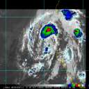
During the overnight hours, there appears to have been a steady increase in the amount and extent of convective activity associated with this system, and moreover and more recently, although convection is warming somewhat, it appears that it's becoming better organized, and this Invest is now beginning to take on a rather 'healthy looking' appearance, as suggested by this animated visible satellite imagery.


Looking carefully at this animation, I'm noticing the beginnings of what might be considered convective banding features, with discernible arced shaped banding wrapping around in the northern quadrant of a broad 1012 mb low, and a much longer, yet more linear feature, being drawn into the developing circulation from the WSW.


Although convection is not quite as deep, with slightly warmer cloud tops, as compared to the overnight hours, this is rather typical during daylight hours, presumably because of the so called 'diurnal convective minimum' cycle, owing to the slightly warmer ambient temperatures at cloud top levels. Tonight should be rather telling, however, and we should expect to see a dramatic increase, again, of the type of sustained, deep, bursting convection that occurred last night.

Also becoming noticeable this morning is a slow NW'ward movement of the overall circulation envelope, which now appears to be crossing over 35 W longitude, near 7 degrees N, as model guidance is beginning to suggest, now that several runs have been compiled. Model consensus is rather clustered towards a general WNW or NW motion through the next few days, unfortunately tracking it right towards the Caribbean Windward Islands, or Lesser Antilles.

As mentioned previously, the probability of this Invest becoming a tropical cyclone in the next 48 hours has been increased to 30%, and the latest (8am EDT) tropical weather discussion from the TPC / NHC has begun to refer to this system as a "Special Feature".

A BROAD AREA OF LOW PRESSURE FOCUSED ON A 1012 MB SURFACE LOW IS CENTERED NEAR 07N34W IN THE CENTRAL TROPICAL ATLANTIC ... THE UPPER AND LOWER LEVEL ATMOSPHERIC CONDITIONS IN THE VICINITY OF THE LOW CONTINUE TO EXHIBIT FAVORABLE CHARACTERISTICS FOR CONTINUED ORGANIZATION OVER THE NEXT COUPLE OF DAYS.

And as the last few TPC tropical discussions have mentioned, the broad surface low appears to be following the westward propagating wave axis, in a field of high preciptable water content and low upper level wind shear, both conducive and essential for tropical cyclogenesis to occur.

A LARGE AREA OF DEEP LAYER MOISTURE IS NOTED IN THE TOTAL PRECIPITABLE WATER IMAGERY THIS MORNING EXTENDING FROM THE EQUATOR TO 11N BETWEEN 25W-41W. THE MOISTURE AND INSTABILITY SURROUNDING THE LOW IS GENERATING NUMEROUS MODERATE AND SCATTERED STRONG CONVECTION.

ALOFT, AN UPPER LEVEL ANTICYCLONIC CIRCULATION IS CENTERED OVER THE CAPE VERDE ISLANDS ... AND UPPER LEVEL DIFFLUENCE ASSOCIATED WITH THE (ASSOCIATED) UPPER LEVEL RIDGE IS HELPING TO VENTILATE CONVECTION AND SUSTAIN LIFT IN THE SURFACE TO MID-LEVEL CYCLONIC CIRCULATION.


In short, IMHO, this strong tropical wave has a lot going for it, with SHIPS Intensity guidance nearing hurricane strength in 36 hours from the last model run, which seems rather high, and presumably due to the expected redevelopment of deep, bursting and cycling convection near and over the nascent LLC center in the upcoming overnight hours, when the diurnal convective maximum will be at it's greatest, and the possible development of a CDO feature over the LLC.

I, for one, am more bullish on development of this system, at least in the short term, than some here for these reasons:

1) A broad, low level circulation with an embedded 1012 mb low is already well established.
2) Very high values of precipitable water are over a large area for the convection to work with.
3) Very low upper level wind shear is over and ahead of it's expected track, at least short term.
4) A well established upper level ridge overlying the area, providing for good diffluence aloft.
5) No foreseeable entrainment of dry air at low or mid levels and well buffered from the 'SAL layer', further north.
6) Very warm, anomalously high SST's over a broad area, and it's associated higher 'Oceanic Heat Content' value.
7) The apparent recent nascent development of a discernible Low Level Circulation Center.
8) And finally, the apparent increase of 'banding features' associated with this developing circulation.

I think the next Tropical Outlook, due out in a couple hours, might maintain the system as is, for now, considering the convective warming trends we've seen during today's daylight hours. But with all it has going for it, I fully expect to see this system consolidate during tonight's convective max, and we may well be looking at the Atlantic's first tropical cyclone of 2010, Tropical Depression ONE, by sometime tomorrow. This should prove to be very interesting!

...

Edited by CoconutCandy (Sun Jun 13 2010 10:09 PM)

Post Extras Print Post   Remind Me!     Notify Moderator


Entire topic
Subject Posted by Posted on
* Central Atlantic Wave Being Watched MikeCAdministrator Sun Jun 13 2010 02:12 PM
. * * Re: Central Atlantic Wave Being Watched Storm Hunter   Sun Jun 20 2010 08:42 PM
. * * Re: Central Atlantic Wave Being Watched Doombot!   Sun Jun 20 2010 05:17 AM
. * * Re: Central Atlantic Wave Being Watched JoshuaK   Sun Jun 20 2010 02:24 AM
. * * Re: Central Atlantic Wave Being Watched MichaelA   Sat Jun 19 2010 01:08 PM
. * * Re: Central Atlantic Wave Being Watched berrywr   Sat Jun 19 2010 07:30 AM
. * * Re: links and 92L berrywr   Sat Jun 19 2010 07:18 AM
. * * Re: links and 92L Old Sailor   Sat Jun 19 2010 01:58 AM
. * * links and 92L danielwAdministrator   Fri Jun 18 2010 11:07 PM
. * * links saltysenior   Fri Jun 18 2010 10:32 PM
. * * Re: Central Atlantic Wave Being Watched danielwAdministrator   Fri Jun 18 2010 04:32 AM
. * * Re: Central Atlantic Wave Being Watched hogrunr   Thu Jun 17 2010 08:29 PM
. * * Re: Central Atlantic Wave Being Watched Ed in Va   Thu Jun 17 2010 07:30 PM
. * * Re: Central Atlantic Wave Being Watched danielwAdministrator   Thu Jun 17 2010 12:32 PM
. * * Re: Central Atlantic Wave Being Watched JoshuaK   Thu Jun 17 2010 11:54 AM
. * * Re: Central Atlantic Wave Being Watched MikeCAdministrator   Wed Jun 16 2010 04:15 PM
. * * Re: Central Atlantic Wave Being Watched Adam S   Wed Jun 16 2010 04:06 PM
. * * Re: Central Atlantic Wave Being Watched doug   Wed Jun 16 2010 03:17 PM
. * * Re: Central Atlantic Wave Being Watched danielwAdministrator   Wed Jun 16 2010 01:20 PM
. * * Re: Central Atlantic Wave Being Watched rmbjoe1954   Wed Jun 16 2010 12:36 PM
. * * Re: Central Atlantic Wave Being Watched Storm Hunter   Wed Jun 16 2010 04:51 AM
. * * Re: Central Atlantic Wave Being Watched Lamar-Plant City   Wed Jun 16 2010 04:24 AM
. * * Re: Central Atlantic Wave Being Watched Ed DunhamAdministrator   Wed Jun 16 2010 03:43 AM
. * * Re: Central Atlantic Wave Being Watched cieldumort   Wed Jun 16 2010 03:01 AM
. * * Re: Central Atlantic Wave Being Watched hogrunr   Wed Jun 16 2010 12:14 AM
. * * Re: Central Atlantic Wave Being Watched danielwAdministrator   Tue Jun 15 2010 11:54 PM
. * * Re: Central Atlantic Wave Being Watched cieldumort   Tue Jun 15 2010 08:11 PM
. * * Re: 92L and GOM? Storm Hunter   Tue Jun 15 2010 07:31 PM
. * * Re: 92L and GOM? hogrunr   Tue Jun 15 2010 06:26 PM
. * * 92L and GOM? danielwAdministrator   Tue Jun 15 2010 04:10 PM
. * * Re: Central Atlantic Wave Being Watched cieldumort   Tue Jun 15 2010 07:20 AM
. * * Re: Central Atlantic Wave Being Watched Storm Hunter   Tue Jun 15 2010 05:55 AM
. * * Re: Central Atlantic Wave Being Watched Ed DunhamAdministrator   Tue Jun 15 2010 02:11 AM
. * * Re: Central Atlantic Wave Being Watched Joeyfl   Tue Jun 15 2010 01:22 AM
. * * Re: Central Atlantic Wave Being Watched jessiej   Tue Jun 15 2010 12:46 AM
. * * Re: Central Atlantic Wave Being Watched Hugh   Tue Jun 15 2010 12:37 AM
. * * Re: Central Atlantic Wave Being Watched MikeCAdministrator   Mon Jun 14 2010 10:18 PM
. * * Re: Central Atlantic Wave Being Watched Hugh   Mon Jun 14 2010 09:01 PM
. * * Re: Central Atlantic Wave Being Watched Storm Hunter   Mon Jun 14 2010 08:29 PM
. * * Re: Central Atlantic Wave Being Watched cieldumort   Mon Jun 14 2010 04:05 PM
. * * Re: Central Atlantic Wave Being Watched MichaelA   Mon Jun 14 2010 03:37 PM
. * * Re: Central Atlantic Wave Being Watched MikeCAdministrator   Mon Jun 14 2010 01:02 PM
. * * Re: Central Atlantic Wave Being Watched Hugh   Mon Jun 14 2010 12:57 PM
. * * Re: Central Atlantic Wave Being Watched MikeCAdministrator   Mon Jun 14 2010 12:06 PM
. * * Re: Central Atlantic Wave Being Watched Hugh   Mon Jun 14 2010 11:46 AM
. * * Re: Central Atlantic Wave Being Watched MikeCAdministrator   Mon Jun 14 2010 10:51 AM
. * * Re: Central Atlantic Wave Being Watched weathernet   Mon Jun 14 2010 07:15 AM
. * * Re: Central Atlantic Wave Being Watched Clark   Mon Jun 14 2010 12:12 AM
. * * Re: Central Atlantic Wave Being Watched Hugh   Sun Jun 13 2010 11:52 PM
. * * Re: Central Atlantic Wave Being Watched typhoon_tip   Sun Jun 13 2010 11:35 PM
. * * Re: Invest 92L Appears To Be Organizing Better Hugh   Sun Jun 13 2010 05:29 PM
. * * Re: Invest 92L Appears To Be Organizing Better MichaelA   Sun Jun 13 2010 05:18 PM
. * * Re: Invest 92L Appears To Be Organizing Better scottsvb   Sun Jun 13 2010 03:30 PM
. * * Re: Invest 92L Appears To Be Organizing Better Scottsvb1   Sun Jun 13 2010 03:27 PM
. * * Re: Invest 92L Appears To Be Organizing Better Hugh   Sun Jun 13 2010 02:38 PM
. * * Invest 92L Appears To Be Organizing Better CoconutCandy   Sun Jun 13 2010 02:12 PM
. * * Re: Central Atlantic Wave Being Watched MikeCAdministrator   Sun Jun 13 2010 01:40 PM
. * * Re: Central Atlantic Wave Being Watched marco67red   Sun Jun 13 2010 01:31 PM
. * * Re: Central Atlantic Wave Being Watched MikeCAdministrator   Sun Jun 13 2010 12:45 PM
. * * Re: Central Atlantic Wave Being Watched danielwAdministrator   Sun Jun 13 2010 12:21 PM
. * * Re: Central Atlantic Wave Being Watched cieldumort   Sun Jun 13 2010 07:38 AM
. * * Re: Central Atlantic Wave Being Watched Storm Hunter   Sun Jun 13 2010 05:20 AM
. * * Re: Central Atlantic Wave Being Watched LoisCane   Sun Jun 13 2010 04:49 AM

Extra information
0 registered and 33 anonymous users are browsing this forum.

Moderator:  


Forum Permissions
      You cannot start new topics
      You cannot reply to topics
      HTML is disabled
      UBBCode is enabled

Rating:
Thread views: 27298

Rate this thread

Jump to

Note: This is NOT an official page. It is run by weather hobbyists and should not be used as a replacement for official sources. 
CFHC's main servers are currently located at Hostdime.com in Orlando, FL.
Image Server Network thanks to Mike Potts and Amazon Web Services. If you have static file hosting space that allows dns aliasing contact us to help out! Some Maps Provided by:
Great thanks to all who donated and everyone who uses the site as well. Site designed for 800x600+ resolution
When in doubt, take the word of the National Hurricane Center