Quote:
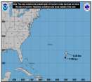
I'm looking at the visible loop, and 20N 70W looks pretty close to me, but your positioning is plausible too, Mike. Overall, it looks a bit like somethng took a knife to the whole system overnight. NHC says it's still code red, but down to 60%, and I think that's very generous - but then again, I thought 70% last night was too low. Models haven't shifted southward to correspond to a shallower system, though, which is curious. In fact, models (at 2am, I haven't seen the 8am run yet) are in very disturbing agreement, that ultimate landfall will be in the Florida panhandle, near Ft. Walton Beach. That there is so much agreement this far out is alarming.
Edit: Just went to Skeetobyte, which has the 12z model runs. They all point to the LA/TX border.
You understand it is not even developed yet so the models are really out to dry till it does to say Florida panhandle is insane.In fact the newer ones have it going north more and up the north coast of Florida.
Until it OR IF it becomes a storm the models are really of little use.
|


 Flat
Flat


