F
Current Radar or Satellite Image

Flhurricane.com - Central Florida Hurricane Center - Tracking Storms since 1995Hurricanes Without the Hype! Since 1995


First day of the Atlantic Hurricane season, no tropical activity on the horizon in the near term. Mid August is usually when things pick up.
Days since last H. Landfall - US: Any 286 (Idalia) , Major: 286 (Idalia) Florida - Any: 286 (Idalia) Major: 286 (Idalia)


Archives 2010s >> 2010 News Talkbacks

typhoon_tip
Meteorologist


Reged:
Posts: 576
Re: Earl Approaching the Leeward Islands
      Sun Aug 29 2010 03:14 PM

Some observations this Sunday morning ...

From East to West across the Basin:

Firstly, there is an impressive TW over the African continent that is approximately a day/day and a half from the Prime Meridian. We shall remain in a general favorable environment for development even after Invest97L has decided upon an evolution.

97L:
From the best of what I can see over at CIMSS and REMSS' suite of products is that the SSTs in the wake of D. and E. have not been significantly reduced; oceanic heat content has not yet been perturbed to where a TC genesis would be impeded, currently exceeding 28C along I97L's current trajectory.

The deep layer shear analysis is negligible when factoring in Storm Relative Shear this morning, and modeled to remain that way as 97L moves along to the W at nearly the same speed as any easterly shear. Any short interval shear promoting influences notwithstanding, this looks to continue. By and large this system does not appear to be fluid mechanically challenged over the next 48 to 72 hours.

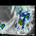
SAL on the other hand (I believe) is stemming the growth of this system, just as I feel it did with Earl, and also caused an unexpected interval of weakness with Danielle. This time sensitive image clearly shows 97L is surrounded by SAL contaminated air on all but the southern semi-circle:


I believe it will take a full day ...perhaps 1.5 to clear this region and in that time there will more likely be burst of convection that settle back into a background tendency for only slow or static growth. 97L has a large circulation field (similar to Earl) that is well established and this will help maintain its eventual potential while it passes through the SAL region(s).

Earl:
Earl's large circulation field (I believe) is partial in why he is taking longish to develop.

There would have needed to be an intervening level of shear that was problematic earlier yesterday. TPC's low, mid, and high level wind overlays did not indicate significant vectors. Nevertheless, satellite presentation over all seemed to suggest some "tipping" toward the S/SW of the colder cloud top regions.

I also think that until the overnight yesterday SAL was still also partial in retarding some.

That's all by the boards now though and it seems the only thing that is opposing a more rapid development at this time is in fact his big size.

Currently the GFDL appears to be the model of choice for Earl. Most of the global numerical guidance, including the higher resolution types, were demonstrating a polarward bias in their 00-12hr/24hr motion off the 00z guidance. The GFDL however has been dead on as far as I can tell. This unfortunately does not outright mean one should hang hat on its ideas beyond 72 hours, as any model enters increased error at those time frames. Nonetheless, it is disconcerting that it, as well as the global numerical guidace (ECMWF, GFS, CMC...etc) et al have all be edging the track guidance further W in time. Not to delve too deeply into speculation but I think Danielle's processing large latent heat flux into the surrounding medium N of 30 N is having a transitive effect on the track guidance as this evolves. Without getting too complex the reason is because increasing latent heat into a ridge will strengthen said ridge, and that would then go on to having an effect on the steering levels.

After the Puerto Rico archipelago, as it stands now, the next concern is along the entire East Coast of N/A from Florida to Maine. This needs to be monitored for less than direct impact factors surrounding the surf. The blend of all models already bring an intense Earl close enough to pound regions with unforgiving wave action, which of course has beach erosion and real-estate, along with general marine activity concerns. Currently there are points of rip-current surf advisories along the East Coast for long-shore swell action from Danielle, which passed safely E of Bermuda! This goes to show that radial wave energies can be impressive at longer ranges; in this case, most guidance bring Earl between Bermuda and East Coast longitudes. This is becoming a bigger concern considering the intensity guidance combined with Earl's large size.

Danielle:
Fun eye-candy in route to the N/Atlantic graveyard. Shipping routes are the only regions threatened by a slow transition to extra-tropical characteristics over the next 2. ...3 days. Eventually Danielle or Danielle's remains will merge (most probably) into a sub-polar vortex in the far N/Atlantic.

Edited by danielw (Sun Aug 29 2010 03:52 PM)

Post Extras Print Post   Remind Me!     Notify Moderator


Entire topic
Subject Posted by Posted on
* Fiona Forms, Earl Now Cat 4, North of the Virgin Islands MikeCAdministrator Sun Aug 29 2010 03:14 PM
. * * Re: Earl and Fiona danielwAdministrator   Mon Aug 30 2010 10:06 PM
. * * Re: Earl and Fiona MichaelA   Mon Aug 30 2010 09:32 PM
. * * Re: Earl and Fiona danielwAdministrator   Mon Aug 30 2010 09:27 PM
. * * Re: Earl and Fiona MikeCAdministrator   Mon Aug 30 2010 08:55 PM
. * * Earl and Fiona danielwAdministrator   Mon Aug 30 2010 08:53 PM
. * * Re: Earl oops Ed DunhamAdministrator   Mon Aug 30 2010 08:35 PM
. * * Re: Earl oops Storm Hunter   Mon Aug 30 2010 08:16 PM
. * * Re: Earl oops Rich B   Mon Aug 30 2010 08:16 PM
. * * Earl oops danielwAdministrator   Mon Aug 30 2010 07:57 PM
. * * Re: 97L Update ftlaudbob   Mon Aug 30 2010 07:34 PM
. * * Re: 97L Update MichaelA   Mon Aug 30 2010 06:57 PM
. * * 97L Update danielwAdministrator   Mon Aug 30 2010 06:37 PM
. * * Re: Earl Approaching the Leeward Islands danielwAdministrator   Mon Aug 30 2010 06:33 PM
. * * Re: Earl Approaching the Leeward Islands MichaelA   Mon Aug 30 2010 05:37 PM
. * * Re: Earl Approaching the Leeward Islands MikeCAdministrator   Mon Aug 30 2010 05:34 PM
. * * Re: Earl Approaching the Leeward Islands syfr   Mon Aug 30 2010 05:29 PM
. * * Re: Earl Approaching the Leeward Islands shewtinstars   Mon Aug 30 2010 05:13 PM
. * * Re: Earl Approaching the Leeward Islands danielwAdministrator   Mon Aug 30 2010 05:11 PM
. * * Re: Earl Approaching the Leeward Islands MichaelA   Mon Aug 30 2010 04:52 PM
. * * Re: Earl Approaching the Leeward Islands LoisCane   Mon Aug 30 2010 04:41 PM
. * * Re: Earl Approaching the Leeward Islands MichaelA   Mon Aug 30 2010 04:27 PM
. * * Re: Earl Approaching the Leeward Islands danielwAdministrator   Mon Aug 30 2010 04:02 PM
. * * Re: Earl Approaching the Leeward Islands scottsvb   Mon Aug 30 2010 03:09 PM
. * * Re: Earl Approaching the Leeward Islands Beaumont, TX   Mon Aug 30 2010 02:59 PM
. * * Re: Earl Approaching the Leeward Islands Ed DunhamAdministrator   Mon Aug 30 2010 02:47 PM
. * * Re: Earl Just Over the Leeward Islands MikeCAdministrator   Mon Aug 30 2010 02:38 PM
. * * Re: Earl Approaching the Leeward Islands danielwAdministrator   Mon Aug 30 2010 02:35 PM
. * * Re: Earl Approaching the Leeward Islands Evan Johnson   Mon Aug 30 2010 02:26 PM
. * * Re: Earl Approaching the Leeward Islands Jasonch   Mon Aug 30 2010 02:08 PM
. * * Re: Earl Approaching the Leeward Islands danielwAdministrator   Mon Aug 30 2010 01:49 PM
. * * Re: Earl Approaching the Leeward Islands doug   Mon Aug 30 2010 01:41 PM
. * * Re: Earl Approaching the Leeward Islands Ed DunhamAdministrator   Mon Aug 30 2010 01:27 PM
. * * Re: Earl Approaching the Leeward Islands MikeCAdministrator   Mon Aug 30 2010 01:20 PM
. * * Re: Earl Approaching the Leeward Islands MikeCAdministrator   Mon Aug 30 2010 12:57 PM
. * * Re: Earl Approaching the Leeward Islands typhoon_tip   Mon Aug 30 2010 01:37 AM
. * * Re: Earl Approaching the Leeward Islands Joeyfl   Mon Aug 30 2010 01:29 AM
. * * Re: Earl Approaching the Leeward Islands Storm Hunter   Mon Aug 30 2010 12:12 AM
. * * Re: Earl Approaching the Leeward Islands Storm Hunter   Sun Aug 29 2010 11:44 PM
. * * Re: Earl Approaching the Leeward Islands Random Chaos   Sun Aug 29 2010 10:35 PM
. * * Re: Earl Approaching the Leeward Islands MichaelA   Sun Aug 29 2010 09:41 PM
. * * Re: Earl Approaching the Leeward Islands Random Chaos   Sun Aug 29 2010 07:53 PM
. * * Re: Earl Approaching the Leeward Islands danielwAdministrator   Sun Aug 29 2010 06:05 PM
. * * Re: Earl Approaching the Leeward Islands Ed DunhamAdministrator   Sun Aug 29 2010 05:33 PM
. * * Re: Earl Random Chaos   Sun Aug 29 2010 05:14 PM
. * * Re: Earl danielwAdministrator   Sun Aug 29 2010 04:57 PM
. * * Earl Vortex Report danielwAdministrator   Sun Aug 29 2010 04:23 PM
. * * Re: Earl Approaching the Leeward Islands WeatherNut   Sun Aug 29 2010 04:21 PM
. * * Re: Earl Approaching the Leeward Islands typhoon_tip   Sun Aug 29 2010 04:19 PM
. * * Re: Earl Approaching the Leeward Islands scottsvb   Sun Aug 29 2010 03:47 PM
. * * Re: Earl Approaching the Leeward Islands MikeCAdministrator   Sun Aug 29 2010 03:30 PM
. * * Re: Earl Approaching the Leeward Islands typhoon_tip   Sun Aug 29 2010 03:14 PM
. * * Re: Earl Approaching the Leeward Islands scottsvb   Sun Aug 29 2010 01:36 PM
. * * Re: Earl Approaching the Leeward Islands MikeCAdministrator   Sun Aug 29 2010 12:31 PM
. * * Re: Earl Approaching the Leeward Islands MikeCAdministrator   Sun Aug 29 2010 12:20 PM
. * * Re: Earl Approaching the Leeward Islands MikeCAdministrator   Sun Aug 29 2010 12:08 PM
. * * Re: Earl Approaching the Leeward Islands MikeCAdministrator   Sun Aug 29 2010 11:42 AM

Extra information
0 registered and 22 anonymous users are browsing this forum.

Moderator:  


Forum Permissions
      You cannot start new topics
      You cannot reply to topics
      HTML is disabled
      UBBCode is enabled

Rating:
Thread views: 27615

Rate this thread

Jump to

Note: This is NOT an official page. It is run by weather hobbyists and should not be used as a replacement for official sources. 
CFHC's main servers are currently located at Hostdime.com in Orlando, FL.
Image Server Network thanks to Mike Potts and Amazon Web Services. If you have static file hosting space that allows dns aliasing contact us to help out! Some Maps Provided by:
Great thanks to all who donated and everyone who uses the site as well. Site designed for 800x600+ resolution
When in doubt, take the word of the National Hurricane Center