Rapidly Intensifying Hurricane 'Adrian' has become a Major Cat 3 Storm in the Eastern Pacific Basin, fortunately well west of Mexico.
'Adrian' intensified quite rapidly over warm waters in a low shear environment and went from Cat. 1 ( about 75 mph) to Major Cat 3 Status (115 mph) in just 15 hours time.
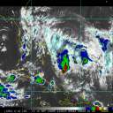
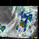
This visible light photo of Hurricane 'Adrian' was taken early this morning, local basin time, just prior to upgrade to Cat 3 status.
And now, from the most recent bulletin from the NHC, as of post time:
ADRIAN HAS DEVELOPED A DISTINCT EYE WHICH IS EMBEDDED WITHIN A RATHER LARGE AND SYMMETRICAL CENTRAL DENSE OVERCAST. THE HURRICANE DISPLAYS A WELL ESTABLISHED UPPER-LEVEL OUTFLOW WITH NO SIGNS OF SHEAR.
BOTH SUBJECTIVE AND OBJECTIVE DVORAK T-NUMBERS HAVE INCREASED THIS MORNING ... AND SUPPORT AN INITIAL INTENSITY OF 100 KNOTS. THIS MAKES ADRIAN A CATEGORY 3 HURRICANE ...
Please visit the NHC website for more information and additional graphics on 'Adrian'.



 Previous
 Index
Index
 Next
Next
 Flat
Flat
 Major Cat 3 Hurricane ADRIAN West of Mexico
 Edit
Edit
 Reply
Reply
 Quote
Quote
 Rapidly Intensifying Hurricane 'Adrian' has become a Major Cat 3 Storm in the Eastern Pacific Basin, fortunately well west of Mexico.


