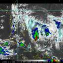
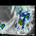
Although only a 35 Knot Tropical Storm at the moment, it is very well organized, as this 'first light' visible still photo reveals.
You can see the Island of Okinawa just to the left of storm as it tracks essentially westward, with a slight dip in the center's track upon closest approach to the Island.
It's going to be a slow mover, so torrential rains, rather than damaging winds, and the very real possibility of flash flooding and life threatening mudslides remain as potential specters.
--- animated visible loop forthcoming ---
Although not expected to strengthen significantly, it's quite possible that 'TS 'Roke' will begin to recurve towards Japan with increasing forward speed towards the end of the current forecast period.
Barring the possibility of unprecedented flash flooding, Roke's impact on the Island should not be as severe as Typhoon 'Songda', which occurred in late May of this year.
( Thanks Ed, for posting on Typhoon Songda earlier this year. ---> CAT 4 Typhoon Songda )
...
Edited by Ed Dunham (Thu Sep 15 2011 11:47 PM)
Post Extras
Entire topic
Subject
Posted by
Posted on
WestPac Tropical Storm 'ROKE' to pass very near to Kadena



 Previous
 Index
Index
 Next
Next
 Flat
Flat
 WestPac Tropical Storm 'ROKE' to pass very near to Kadena
 Edit
Edit
 Reply
Reply
 Quote
Quote


