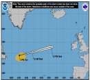
Today marks the start of the Eastern Pacific Hurricane Season. Atlantic Outlooks also begin today.
Days since last Hurricane Landfall —
US Any:
592 (Milton),
US Major:
592 (Milton),
FL Any:
592 (Milton),
FL Major:
592 (Milton)
Ed Dunham
Former Meteorologist & CFHC Forum Moderator (Ed Passed Away on May 14, 2017)
Reged:
Posts: 2565
Loc: Melbourne, FL
|
Weather Reports - Tropical Wave Approaching Florida
Sun Jul 22 2012 03:53 PM
|
|
|
Melbourne NWS reports a wind gust to 51mph at Valkaria as the leading edge of the tropical wave to the east and southeast moved into the east central Florida area. Other earlier reports:
PRELIMINARY LOCAL STORM REPORT NATIONAL WEATHER SERVICE MELBOURNE FL 250 PM EDT SUN JUL 22 2012

..TIME... ...EVENT... ...CITY LOCATION... ...LAT.LON... ..DATE... ....MAG.... ..COUNTY LOCATION..ST.. ...SOURCE.... ..REMARKS..
0212 PM TSTM WND GST 6 W BASINGER 27.40N 81.11W 07/22/2012 M60 MPH OKEECHOBEE FL MESONET
SFWMD S65CW WIND 107/21 GUSTS 52 KTS.
0230 PM TSTM WND GST 3 SSW PORT SAINT LUCIE 27.24N 80.37W 07/22/2012 M60 MPH ST. LUCIE FL TRAINED SPOTTER
SPOTTER REPORTED STEADY WINDS 40KTS WITH GUSTS TO 52 KTS. BEEN BLOWING FOR 10 TO 20 MINUTES.
0231 PM TSTM WND GST FORT PIERCE 27.44N 80.32W 07/22/2012 M46 MPH ST. LUCIE FL ASOS
KFPR ASOS OBSERVATION REMARK PK WND 11041/1831.
ED
Edited by Ed Dunham (Sun Jul 22 2012 04:05 PM)
|
|
0 registered and 1 anonymous users are browsing this forum.
Moderator:
|
Forum Permissions
You cannot start new topics
You cannot reply to topics
HTML is disabled
UBBCode is enabled
|
Rating:
Thread views: 5379
|
|
|
|
|
|
Note: This is
NOT an official page. It is run by weather hobbyists and should not be used as a replacement for official sources.
CFHC's main servers are currently located at
Hostdime.com in Orlando, FL.
Image Server Network thanks to Mike Potts and Amazon Web Services. If you have static file hosting space that allows dns aliasing contact us to help out! Some Maps Provided by:
Great thanks to all who
donated and everyone who uses the site as well.
Site designed for 800x600+ resolution
When in doubt, take the word of the
National Hurricane Center