F
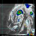
Current Radar or Satellite Image

Flhurricane.com - Central Florida Hurricane Center - Tracking Storms since 1995Hurricanes Without the Hype! Since 1995


Invest 95L near 100% chance to develop, advisories likely to come later today. Hurricane and/or Tropical Storm Watches are possible later tonight for parts of the Windward islands of the Caribbean. Area east of that 30% chance. 94L 30% chance.
Days since last H. Landfall - US: Any 303 (Idalia) , Major: 303 (Idalia) Florida - Any: 303 (Idalia) Major: 303 (Idalia)
9.1N 41.9W
Wind: 35MPH
Pres: 1007mb
Moving:
W at 21 mph
Click for Storm Spotlight
Invest 94LClick for Invest Information from CIMSS
COMMUNICATION
STORM DATA
CONTENT
FOLLOW US


Archives 2010s >> 2012 Storm Forum

cieldumort
Moderator


Reged:
Posts: 2328
Loc: Austin, Tx
Area of Concern - Hurricane Ernesto
      Mon Jul 30 2012 03:12 AM

After a lull we now have two distinct tropical waves approaching the Caribbean. As of this entry, the nearest is centered around 14N 62.5W, and is encountering strong shear. The second, which is accompanied by a surface low, is centered near 9.5N 34.5W, and in addition to being the more vigorous of the two, is also enjoying slightly favorable upper level winds. This second feature has been tagged Invest 99L. The estimated center location of 99L noted above is a rough approximation, and subject to change.

Presently, Invest 99L is fairly disorganized, but has been becoming somewhat less so overnight. Maximum sustained winds are estimated to be running about 25MPH, with a minimum pressure of 1010mb. The feature consists of a robust tropical wave with a discernible surface low, and is triggering isolated to scattered showers and thunderstorms.

Slow development, if any, is the most probable outcome, thus should 99L not develop within the next 3 or so days it could then have a chance to become a named storm if in the Caribbean. Development sooner rather than later would encourage, but not guarantee, a pull more to the northwest, or north, which could result in a course more towards the Greater Antilles, or even out to sea .


(Updated to reflect new thread title and hurricane status. )

Edited by cieldumort (Tue Aug 07 2012 02:47 PM)

Post Extras Print Post   Remind Me!     Notify Moderator


Entire topic
Subject Posted by Posted on
* Area of Concern - Hurricane Ernesto cieldumort Mon Jul 30 2012 03:12 AM
. * * Re: Area of Concern - Hurricane Ernesto cieldumort   Tue Aug 07 2012 03:00 PM
. * * Re: Area of Interest: Tropical Storm Ernesto cieldumort   Wed Aug 01 2012 05:13 PM
. * * Re: Area of Interest: Tropical Storm Ernesto Ed DunhamAdministrator   Thu Aug 02 2012 09:35 PM
. * * Re: Area of Interest: Tropical Storm Ernesto Ed DunhamAdministrator   Sun Aug 05 2012 08:10 AM
. * * Re: Area of Interest: Tropical Storm Ernesto Ed DunhamAdministrator   Mon Aug 06 2012 09:50 AM
. * * Re: Area of Concern - Tropical Storm Ernesto Ed DunhamAdministrator   Mon Aug 06 2012 11:50 AM
. * * Re: Area of Concern - Tropical Storm Ernesto Ed DunhamAdministrator   Mon Aug 06 2012 11:41 PM
. * * Re: Area of Concern - Hurricane Ernesto Ed DunhamAdministrator   Tue Aug 07 2012 05:42 PM
. * * Re: Area of Concern - Hurricane Ernesto Ed DunhamAdministrator   Wed Aug 08 2012 12:32 AM
. * * Re: Area of Concern - Tropical Storm Ernesto Ed DunhamAdministrator   Wed Aug 08 2012 11:30 AM
. * * Re: Area of Concern - Tropical Storm Ernesto Ed DunhamAdministrator   Wed Aug 08 2012 01:12 PM
. * * Re: Area of Concern - Tropical Storm Ernesto berrywr   Tue Aug 07 2012 12:45 AM
. * * Re: Area of Interest: Vigorous Invest 99L cieldumort   Wed Aug 01 2012 01:48 PM
. * * Re: Area of Interest: Vigorous Invest 99L Joeyfl   Wed Aug 01 2012 03:14 PM

Extra information
0 registered and 35 anonymous users are browsing this forum.

Moderator:  


Forum Permissions
      You cannot start new topics
      You cannot reply to topics
      HTML is disabled
      UBBCode is enabled

Rating:
Thread views: 7525

Rate this thread

Jump to

Note: This is NOT an official page. It is run by weather hobbyists and should not be used as a replacement for official sources. 
CFHC's main servers are currently located at Hostdime.com in Orlando, FL.
Image Server Network thanks to Mike Potts and Amazon Web Services. If you have static file hosting space that allows dns aliasing contact us to help out! Some Maps Provided by:
Great thanks to all who donated and everyone who uses the site as well. Site designed for 800x600+ resolution
When in doubt, take the word of the National Hurricane Center