F
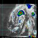
Current Radar or Satellite Image

Flhurricane.com - Central Florida Hurricane Center - Tracking Storms since 1995Hurricanes Without the Hype! Since 1995


Gulf area up to 60% chance for weak development. A new Atlantic system is now up with a 20% chance for development, FL east coast and GA coast should watch for mid-late this week.**
Days since last H. Landfall - US: Any 291 (Idalia) , Major: 291 (Idalia) Florida - Any: 291 (Idalia) Major: 291 (Idalia)


Archives 2010s >> 2012 Forecast Lounge

danielwAdministrator
Moderator


Reged:
Posts: 3525
Loc: Hattiesburg,MS (31.3N 89.3W)
99L Thoughts...
      Wed Aug 01 2012 03:38 AM

99L continues to develop. NHC is now giving it a 50% chance at becoming a Named Tropical Cyclone. As of the 8 PM EDT Advisory tonight.
I did some research on storms passing through, or originating in the 10.0N / 45.0W area and the list follows.
Using 10.0N/ 45.0W as point with a 60nm radius.

TS Arthur: July 22 to July 27,1990

Cat 4 Hurricane Flora: September 26, to October 13,1963

Unnamed TD: June 11 to June 11,2003 dissipated

Cat 5 Ivan: September 4 to September 24, 2004 (passed thru 10N/ 45W as Cat 1 Hurricane.)Only system to achieve Hurricane status before passing through the area.

Unnamed Cat 3: September 6 to September 17, 1921

Cat 1 Fifi: September 4 to September 12,1958

Cat 4 Lili: September 21 to October 4,2002

TS Bret: August 4 to August 11,1993

TS Alma: August 12 to August 15, 1974

Cat 1 Gertrude: September 27 to October 4, 1974

TS Christine: August 25 to September 4, 1973

Cat 5 Emily: July 11 to July 21,2005

Only two of the above systems made landfall in the U.S.

Ivan made initial landfall on the Florida Panhandle and recurved back several days later to make a second landfall in SE Texas. Lili's landfall was on the Central Louisiana Coast.


http://csc.noaa.gov/hurricanes/#

Post Extras Print Post   Remind Me!     Notify Moderator


Entire topic
Subject Posted by Posted on
* Tropical Waves - Invest 91L Ed DunhamAdministrator Wed Aug 01 2012 03:38 AM
. * * Re: Tropical Waves - Invest 91L ftlaudbob   Sat Aug 04 2012 06:45 AM
. * * Re: Tropical Waves - Invest 91L Ed DunhamAdministrator   Sat Aug 04 2012 11:23 PM
. * * Re: Tropical Waves - Invest 91L Ed DunhamAdministrator   Sun Aug 05 2012 12:00 PM
. * * Re: Invest 91L Lounge Random Chaos   Fri Aug 03 2012 09:16 PM
. * * Re: Tropical Waves Ed DunhamAdministrator   Mon Jul 30 2012 04:43 AM
. * * Re: Tropical Waves cieldumort   Mon Jul 30 2012 06:23 AM
. * * Re: Tropical Waves danielwAdministrator   Mon Jul 30 2012 10:25 AM
. * * 99L Thoughts... danielwAdministrator   Wed Aug 01 2012 03:38 AM
. * * Re: 99L Thoughts... Ed DunhamAdministrator   Wed Aug 01 2012 05:22 AM
. * * Invest 91L Lounge Ed DunhamAdministrator   Fri Aug 03 2012 07:47 PM

Extra information
0 registered and 7 anonymous users are browsing this forum.

Moderator:  


Forum Permissions
      You cannot start new topics
      You cannot reply to topics
      HTML is disabled
      UBBCode is enabled

Rating:
Thread views: 6210

Rate this thread

Jump to

Note: This is NOT an official page. It is run by weather hobbyists and should not be used as a replacement for official sources. 
CFHC's main servers are currently located at Hostdime.com in Orlando, FL.
Image Server Network thanks to Mike Potts and Amazon Web Services. If you have static file hosting space that allows dns aliasing contact us to help out! Some Maps Provided by:
Great thanks to all who donated and everyone who uses the site as well. Site designed for 800x600+ resolution
When in doubt, take the word of the National Hurricane Center