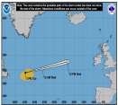
Today marks the start of the Eastern Pacific Hurricane Season. Atlantic Outlooks also begin today.
Days since last Hurricane Landfall —
US Any:
592 (Milton),
US Major:
592 (Milton),
FL Any:
592 (Milton),
FL Major:
592 (Milton)
cieldumort
Moderator
Reged:
Posts: 2664
Loc: Austin, Tx
|
Area of Interest: Invest 95L
Sun Aug 19 2012 02:14 PM
|
|
|
A convectively active surface trough which includes some of the remnant circulation of (former) Helene has become a little better defined over the extreme western Gulf of Mexico today. This feature has been tagged as Invest 95L.
95L is in a marginally favorable environment for further organization, currently centered roughly around 21.7N 98.1W. Movement is nearly stationary, or drifting on and offshore.
The estimated minimum central pressure within 95L is a relatively low 1005mb, and maximum sustained winds are running about 20 knots, but scatterometer measurements suggests that much higher gusts are occurring.
NHC currently gives this disturbance a 20% chance of becoming a numbered tropical cyclone within 48 hours.

|
|
0 registered and 1 anonymous users are browsing this forum.
Moderator:
|
Forum Permissions
You cannot start new topics
You cannot reply to topics
HTML is disabled
UBBCode is enabled
|
Rating:
Thread views: 3651
|
|
|
|
|
|
Note: This is
NOT an official page. It is run by weather hobbyists and should not be used as a replacement for official sources.
CFHC's main servers are currently located at
Hostdime.com in Orlando, FL.
Image Server Network thanks to Mike Potts and Amazon Web Services. If you have static file hosting space that allows dns aliasing contact us to help out! Some Maps Provided by:
Great thanks to all who
donated and everyone who uses the site as well.
Site designed for 800x600+ resolution
When in doubt, take the word of the
National Hurricane Center