F
Current Radar or Satellite Image

Flhurricane.com - Central Florida Hurricane Center - Tracking Storms since 1995Hurricanes Without the Hype! Since 1995


Western Gulf and NW Caribbean increasingly favored for development potential over the next week or so.
Days since last H. Landfall - US: Any 290 (Idalia) , Major: 290 (Idalia) Florida - Any: 290 (Idalia) Major: 290 (Idalia)


Archives 2010s >> 2013 Forecast Lounge

cieldumort
Moderator


Reged:
Posts: 2312
Loc: Austin, Tx
Invest 95L Lounge
      Mon Sep 16 2013 05:51 PM


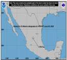
Above: Most Recent Vis/IR Image of Invest 95L

A new disturbance is slowly developing in the northwestern Caribbean as of 9/16. This feature does not yet have an Invest tag, but could get one later today or tomorrow, at which time this post will be edited to reflect the Invest number.

Residual moisture and energy left in the wake of Hurricane Ingrid is interacting with a tropical wave. As of midday Thursday, 9/16, a vorticity max in the mid levels with an apparent reflection at the surface is located around 17.5N 88W, and moving generally in a wnw to nw direction.

Nearly all the major models at least hint at yet another tropical cyclone trying to form in or around the southwestern Gulf of Mexico this week, and so far it looks as if this NW Caribbean disturbance has the best shot, although some runs suggest that perhaps Ingrid's remains will loop back around into the Bay of Campeche, and either reform and/or merge with the feature. Additionally, there has been a persistent area of thunderstorms, associated with Ingrid's eastern flank, that remains over open water, just off the coast of Tampico, Mx.

This is where to put mid to long range thoughts on this feature's potential for further development, intensity, and forecast track. Longer range model output discussions are also appropriate here.

Edited to change title to reflect addition of Invest tag. Edited to swap out Western Atlantic IR with Invest 95L Floater. - Ciel

Edited by cieldumort (Tue Sep 17 2013 05:05 AM)

Post Extras Print Post   Remind Me!     Notify Moderator


Entire topic
Subject Posted by Posted on
* Invest 95L Lounge cieldumort Mon Sep 16 2013 05:51 PM
. * * Re: Invest 95L Lounge cieldumort   Sun Sep 22 2013 04:21 PM
. * * Re: Invest 95L Lounge MikeCAdministrator   Wed Sep 18 2013 02:08 AM
. * * Re: Invest 95L Lounge StormMan   Tue Sep 17 2013 10:56 PM
. * * Re: Invest 95L Lounge cieldumort   Wed Sep 18 2013 02:54 AM
. * * Re: Invest 95L Lounge Ed DunhamAdministrator   Wed Sep 18 2013 04:38 AM
. * * Re: Invest 95L Lounge Ed DunhamAdministrator   Wed Sep 18 2013 05:31 PM
. * * Re: Invest 95L Lounge doug   Wed Sep 18 2013 07:02 PM
. * * Re: Invest 95L Lounge Ed DunhamAdministrator   Fri Sep 20 2013 04:45 AM
. * * Re: Invest 95L Lounge Ed DunhamAdministrator   Sun Sep 22 2013 10:07 PM
. * * Re: Invest 95L Lounge cieldumort   Mon Sep 23 2013 11:30 PM
. * * Re: Invest 95L Forecast Lounge Ed DunhamAdministrator   Wed Sep 18 2013 02:44 AM
. * * Re: Invest 95L Lounge doug   Tue Sep 17 2013 03:25 PM
. * * Re: Invest 95L Lounge berrywr   Tue Sep 17 2013 09:39 PM
. * * Re: Invest 95L Lounge Owlguin   Tue Sep 17 2013 06:49 PM
. * * Re: Invest 95L Lounge doug   Tue Sep 17 2013 07:58 PM

Extra information
0 registered and 1 anonymous users are browsing this forum.

Moderator:  


Forum Permissions
      You cannot start new topics
      You cannot reply to topics
      HTML is disabled
      UBBCode is enabled

Rating:
Thread views: 29370

Rate this thread

Jump to

Note: This is NOT an official page. It is run by weather hobbyists and should not be used as a replacement for official sources. 
CFHC's main servers are currently located at Hostdime.com in Orlando, FL.
Image Server Network thanks to Mike Potts and Amazon Web Services. If you have static file hosting space that allows dns aliasing contact us to help out! Some Maps Provided by:
Great thanks to all who donated and everyone who uses the site as well. Site designed for 800x600+ resolution
When in doubt, take the word of the National Hurricane Center