F
Current Radar or Satellite Image

Flhurricane.com - Central Florida Hurricane Center - Tracking Storms since 1995Hurricanes Without the Hype! Since 1995


#Beryl on track to become a Major while crossing or near the Windwards. Low behind it now Invest #96L with 70% odds. #94L in Bay of Campeche as well. What month is this?
Days since last H. Landfall - US: Any 304 (Idalia) , Major: 304 (Idalia) Florida - Any: 304 (Idalia) Major: 304 (Idalia)
10.5N 52.2W
Wind: 90MPH
Pres: 983mb
Moving:
W at 20 mph
Click for Storm Spotlight
Invest 94LClick for Invest Information from CIMSS
Invest 96LClick for Invest Information from CIMSS
COMMUNICATION
STORM DATA
CONTENT
FOLLOW US


General Discussion >> Other Storm Basins

cieldumort
Moderator


Reged:
Posts: 2336
Loc: Austin, Tx
Special Central Pacific Forecast Lounge: Double Trouble Hurricanes Iselle & Julio
      Sat Aug 02 2014 12:04 AM

Rarely seen incredibly active Pacific from west to east this week.

Two systems in particular need to be closely watched by the Hawaiian Islands. One, now a hurricane, and the other, a developing very large tropical low which already has the makings of a tropical depression.

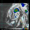
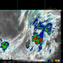
In the image below, I have notated just the Central & Eastern Pacific features, with two of the tropical lows in these basins already named: Central Pacific Genevieve & Eastern Pacific Hurricane Iselle.

Genevieve is passing safely by well south of the islands. It is the eastern Pacific hurricane, and the very large incipient tropical depression behind it, that have the potential to reach the islands later next week, and they may do so with some unusual intensity, as the environment looks like it could be quite favorable.


Early model runs are nearly unanimous in bringing two potent tropical cyclones very close or directly over the islands around the 7th to 10th of August. It is rare that you see this kind of unanimity so far in advance without at least a reasonable degree of verification, and given that the Pacific has been on fire so far this year, and tropical cyclone forecasting going out to two weeks has become much better over the past few years, these forecasts may be worth taking note of.

ECMWF "European"


GFS "American"


Multiple Models & Official NHC 5 Day


Edited Title to reflect addition of newly-named Julio, as well as our decision to use this forum as a de facto East Pac Forecast Lounge for these two tropical cyclones, as they may both impact the state of Hawaii.

Post Extras Print Post   Remind Me!     Notify Moderator


Entire topic
Subject Posted by Posted on
* Special Central Pacific Forecast Lounge: Double Trouble Hurricanes Iselle & Julio cieldumort Sat Aug 02 2014 12:04 AM
. * * Re: Special Central Pacific Forecast Lounge: Double Trouble Hurricanes Iselle & Julio cieldumort   Thu Aug 07 2014 12:01 AM
. * * Re: Special East Pac Forecast Lounge: Potential Double Trouble Iselle & Julio CoconutCandy   Mon Aug 04 2014 07:22 PM
. * * Re: Rarely Seen Incredibly Active Pacific: Hurricane Iselle & Hawaii vpbob21   Sun Aug 03 2014 11:02 PM
. * * Re: Rarely Seen Incredibly Active Pacific: Hurricane Iselle & Hawaii berrywr   Mon Aug 04 2014 12:28 AM
. * * Re: Rarely Seen Incredibly Active Pacific: Hurricane Iselle & Hawaii Ed DunhamAdministrator   Sat Aug 02 2014 01:24 AM

Extra information
0 registered and 16 anonymous users are browsing this forum.

Moderator:  


Forum Permissions
      You cannot start new topics
      You cannot reply to topics
      HTML is disabled
      UBBCode is enabled

Rating:
Thread views: 3869

Rate this thread

Jump to

Note: This is NOT an official page. It is run by weather hobbyists and should not be used as a replacement for official sources. 
CFHC's main servers are currently located at Hostdime.com in Orlando, FL.
Image Server Network thanks to Mike Potts and Amazon Web Services. If you have static file hosting space that allows dns aliasing contact us to help out! Some Maps Provided by:
Great thanks to all who donated and everyone who uses the site as well. Site designed for 800x600+ resolution
When in doubt, take the word of the National Hurricane Center