F
Current Radar or Satellite Image

Flhurricane.com - Central Florida Hurricane Center - Tracking Storms since 1995Hurricanes Without the Hype! Since 1995


Gulf of Mexico Invest #92L now 80% NHC odds of development. Advisories could begin as soon as today or Sunday. #Flwx
Days since last H. Landfall - US: Any 8 (Helene) , Major: 8 (Helene) Florida - Any: 8 (Helene) Major: 8 (Helene)
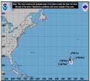
26.2N 50.2W
Wind: 125MPH
Pres: 945mb
Moving:
Nnw at 13 mph
Click for Storm Spotlight
10.7N 34.8W
Wind: 80MPH
Pres: 985mb
Moving:
Wnw at 7 mph
Click for Storm Spotlight
Invest 92LClick for Invest Information from CIMSS
COMMUNICATION
STORM DATA
CONTENT
FOLLOW US


General Discussion >> Other Storm Basins

CoconutCandy
User


Reged:
Posts: 245
Loc: Beautiful Honolulu Hawaii
Hawaiian Islands Due for Hurricane Rendezvous
      Wed Oct 15 2014 05:14 PM

Aloha from Hurricane Harassed Hawaii ...

Unfortunately, Tropical Storm (soon to be Hurricane) "ANA" is still on track to pay it's unwelcomed visitation upon these Beautiful Hawaiian Islands, which may not be quite so beautiful in it's wake.

A sort of "worse case scenario" appears to be unfolding. Here's why:

Unlike Hurricane "ISELLE" (a tropical storm upon landfall) only a few short months ago, which *smack dabbed* into the Big Islands' MASSIVE Mountainous Mauna Loa and had the Living Bejesus knocked out of it (mountainous terrain utterly shreds tropical cyclones to smithereens) ...

... instead, Hurricane "ANA" is currently expected to brush by *just under the southern tip* of the Big Island, (thus, unfortunately, avoiding it's untimely demise at the hands of Mountainous Mauna Loa), and then proceed to make a gentle arc up towards the Smaller Islands of Maui, Oahu and Kauai.

In fact, the latest official track has "ANA" passing *within* a mere 20 miles (Yikes!) of the south coast of Oahu, which would put us in the Strongest, most Dangerous part of the Cyclone; the much dreaded and feared "Eyewall", that horrific maelstrom of damaging wind madly encircling the Calm 'Eye of the Storm'.

Sustained Winds are Currently Forecast to be 80 MPH as it nears Oahu, with GUSTS to 100 MPH, which would then be Amplified even further, due to "Orographic Enhancement" with Oahu's low-slung Mountains, which would NOT act to diminish the storm but, as mentioned, further amplify it's winds.

If the Current track bears out, Oahu is in Grave Danger, the likes of which Modern Metropolis Honolulu has NOT seen in it's Recorded History (dating back to at least 150 years!).

Upper Atmospheric Steering Currents remain *very uncertain* this far out, so please: Let's all *Hope and Pray* that ANA's forecast track veers progressively towards the LEFT with each upcoming advisory, taking the Center of the Cyclone further and further away in it's "closest point of approach", as it skirts south of the Smaller Islands. Seriously: Honolulu does NOT need a Hurricane !!!

Post Extras Print Post   Remind Me!     Notify Moderator


Entire topic
Subject Posted by Posted on
* Central Pacific: TS Ana to approach Hawai'i Stork Wed Oct 15 2014 05:14 PM
. * * Re: Central Pacific: TS Ana to approach Hawai'i Ed DunhamAdministrator   Thu Oct 16 2014 07:13 AM
. * * Re: Central Pacific: TS Ana to approach Hawai'i Ed DunhamAdministrator   Fri Oct 17 2014 09:34 AM
. * * Re: Central Pacific: TS Ana to approach Hawai'i vpbob21   Tue Oct 14 2014 06:18 PM
. * * Hawaiian Islands Due for Hurricane Rendezvous CoconutCandy   Wed Oct 15 2014 05:14 PM

Extra information
0 registered and 3 anonymous users are browsing this forum.

Moderator:  


Forum Permissions
      You cannot start new topics
      You cannot reply to topics
      HTML is disabled
      UBBCode is enabled

Rating:
Thread views: 3975

Rate this thread

Jump to

Note: This is NOT an official page. It is run by weather hobbyists and should not be used as a replacement for official sources. 
CFHC's main servers are currently located at Hostdime.com in Orlando, FL.
Image Server Network thanks to Mike Potts and Amazon Web Services. If you have static file hosting space that allows dns aliasing contact us to help out! Some Maps Provided by:
Great thanks to all who donated and everyone who uses the site as well. Site designed for 800x600+ resolution
When in doubt, take the word of the National Hurricane Center