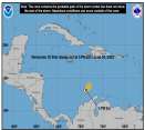
No development is expected in the Atlantic over the next two days, but our eyes are turning to the Caribbean as conditions for development improve heading into November
Days since last H. Landfall - US: Any
20 (Milton)
, Major:
20 (Milton)
Florida - Any: 20 (Milton)
Major:
20 (Milton)
Quote: 0z GFS Run: Updated as it comes in: Starts off similar to the last run,Irma's obviously over warmer water now and we may wake up to a stronger hurricane. Are you saying this is a genuine scenario?
By 36 hours, it's slightly south of the prior GFS Run, maybe 15 or 20 nm, but generally stays the same course until at least 42 hours out.
By Wednesday morning it's getting dangerously close to Barbuda, eyewall goes over Barbuda, then St. Maarten and Anguilla. By the evening it's over the British Virgin Islands (US gets some, but not as much as the northern British VI)
It stays north of Puerto Rico (to avoid the inner core), but still gets tropical storm force and maybe hurricane force along the northern side of PR.
Closer to HIspaniola this run, hits cat 5 late Thursday night as it nears the Turks and Caicos, and over them Friday morning.
Slips west of the Turks and Caicos Friday night, between Cuba and the Bahamas.
Saturday morning just offshore Cuba, then rides the northern coastline of Cuba. Sunday morning drifts north from Cuba into the Florida straits.
Category 5 landfall upper Keys, headed north AM of Sep 11th, maintains strength through Lake Okeechobee with dirty side of storm going through the populated areas of south Florida. Over Orlando (Still cat 4) by afternoon
Back offshore by St. Augustine by the end of the night, still a major another landfall in central Georgia.
Automatic winner for most insane GFS vs Florida run of all time.
Posting it here for the record, 10th straight US landfall prediction for Irma.
If this happens,and we don't know that it will,it would be the biggest natual disater in U.S. history given that angle and the layout of Florida.
--------------------
Survived: 10 hurricanes in Rhode Island,Florida and the Yucatan of Mexico .
0 registered and 107 anonymous users are browsing this forum.
Moderator:
Forum Permissions
You cannot start new topics
You cannot reply to topics
HTML is disabled
UBBCode is enabled
Rating:
Thread views: 1498500
Note: This is NOT an official page. It is run by weather hobbyists and should not be used as a replacement for official sources.
CFHC's main servers are currently located at Hostdime.com in Orlando, FL.
Image Server Network thanks to Mike Potts and Amazon Web Services. If you have static file hosting space that allows dns aliasing contact us to help out! Some Maps Provided by:
Great thanks to all who donated and everyone who uses the site as well.
Site designed for 800x600+ resolution
When in doubt, take the word of the National Hurricane Center