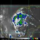
No development is expected in the Atlantic over the next two days, but our eyes are turning to the Caribbean as conditions for development improve heading into November
Days since last H. Landfall - US: Any
20 (Milton)
, Major:
20 (Milton)
Florida - Any: 20 (Milton)
Major:
20 (Milton)
This is definitely looking like one of those rare tracks that will take Irma parallel to the FL west coast, at or just inland. Cuba is taking a toll on Irma's top winds, but the overall circulation still looks good. We can only hope that Irma doesn't re-ignite once over the Florida Straits and SE Gulf. Many of the models, unfortunately, call for re-intensification and there is nothing that should prohibit this in the next 24 hours. I doubt Irma will regain Cat 5 strength, but all bets are off in the warm waters of the SE Gulf. The upper level winds are fairly hostile over the northern Gulf and maybe they will infringe on Irma sooner rather than later. We'll see.
I think the Euro has performed exceptionally well with this system compared to other models (GFS, HWRF) which have consistently been too far north and east. Even the Navgem has done better than those models, though its bias has been too far west. It's looking like a coastal runner up the west coast, unfortunately. My thinking right now is that Irma will weaken to high Cat 2-low Cat3 in the next 12 hours, followed by re-intensification to mid-upper Cat 3 along FL's west coast. The broad circulation may make it more difficult to spin up at the last moment ala Charley. At least that's what I am hoping.
0 registered and 106 anonymous users are browsing this forum.
Moderator:
Forum Permissions
You cannot start new topics
You cannot reply to topics
HTML is disabled
UBBCode is enabled
Rating:
Thread views: 1498500
Note: This is NOT an official page. It is run by weather hobbyists and should not be used as a replacement for official sources.
CFHC's main servers are currently located at Hostdime.com in Orlando, FL.
Image Server Network thanks to Mike Potts and Amazon Web Services. If you have static file hosting space that allows dns aliasing contact us to help out! Some Maps Provided by:
Great thanks to all who donated and everyone who uses the site as well.
Site designed for 800x600+ resolution
When in doubt, take the word of the National Hurricane Center