Current Radar or Satellite Image

Flhurricane.com - Central Florida Hurricane Center - Tracking Storms since 199531 Years of Hurricanes Without the Hype - Since 1995


Nothing on the horizon for Atlantic development at the start of July.
Days since last Hurricane Landfall — US Any: 632 (Milton), US Major: 632 (Milton), FL Any: 632 (Milton), FL Major: 632 (Milton)
FlHurricane Atlantic Tropical Cyclone Tracking 🌀 Since 1995
None
HypeScale:
0.02
0510
Communication
Storm Data
Content
Follow & Connect


Archives 2020s >> 2022 Forecast Lounge

cieldumort
Moderator


Reged:
Posts: 2705
Loc: Austin, Tx
Colin Forecast Lounge
      Sat Jul 02 2022 12:00 AM


A well-defined area of non-tropical low pressure began taking on more tropical characteristics despite moderate westerly shear on the morning of July 1st, and one could make the case that it was a T.D. by about noon Friday July 1 using a more flexible definition.

After drifting just inland near/over Charleston, S.C. the low has continued to slowly show signs of increasing organization.

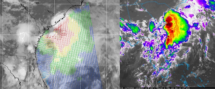
96L is now being tugged offshore and drawn into a blossoming area of deep convection with very cold cloud tops, and it looks increasingly likely that a Tropical Storm may be forming, so we are starting a lounge on this well-formed cyclone at this time.

At 5AM ET July 2, NHC upgraded 96L directly to Tropical Storm Colin, and the title has been updated accordingly.

Edited by cieldumort (Sat Jul 02 2022 06:05 AM)

Post Extras Print Post   Remind Me!     Notify Moderator


Entire topic
Subject Posted by Posted on
* Colin Forecast Lounge cieldumort Sat Jul 02 2022 12:00 AM
. * * Re: Invest 96L Forecast Lounge cieldumort   Sat Jul 02 2022 05:58 AM

Extra information
0 registered and 21 anonymous users are browsing this forum.

Moderator:  


Forum Permissions
      You cannot start new topics
      You cannot reply to topics
      HTML is disabled
      UBBCode is enabled

Rating:
Thread views: 3732

Rate this thread

Jump to