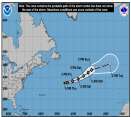
Current Radar or Satellite Image

Flhurricane.com - Central Florida Hurricane Center - Tracking Storms since 199531 Years of Hurricanes Without the Hype - Since 1995


Now closely monitoring the eastern Gulf for potential development within the next 7 days.
Days since last Hurricane Landfall — US Any: 645 (Milton), US Major: 645 (Milton), FL Any: 645 (Milton), FL Major: 645 (Milton)
FlHurricane Atlantic Tropical Cyclone Tracking 🌀 Since 1995
None
HypeScale:
0.39
0510
Communication
Storm Data
Content
Follow & Connect


Archives 2020s >> 2022 Forecast Lounge

cieldumortModerator
Moderator


Reged:
Posts: 2712
Loc: Austin, Tx
Julia Lounge
      Mon Oct 03 2022 02:53 AM

A well formed, convectively active tropical wave located several hundred miles east of the Windwards is moving westward at around 15-20 mph and expected to reach the islands and eastern Caribbean around the middle of the new week. This disturbance not only is showing tentative signs of developing in the near term (next 1-2 days), but a few model runs are warm to very warm on its prospects of becoming a storm even prior to reaching the Lesser Antilles, with others of it at least becoming a TD this week while land-trapped in the Caribbean, and so we are starting a Lounge on the wave and Invest, 91L, at this time.

On the morning of Oct 7th THIRTEEN became Julia, and the title has been updated accordingly. -Ciel


Edited by cieldumort (Fri Oct 07 2022 02:29 PM)

Post Extras Print Post   Remind Me!     Notify Moderator


Entire topic
Subject Posted by Posted on
* Julia Lounge cieldumortModerator Mon Oct 03 2022 02:53 AM
. * * Re: 91L Lounge cieldumortModerator   Thu Oct 06 2022 05:42 PM
. * * Re: 91L Lounge cieldumortModerator   Tue Oct 11 2022 04:49 AM

Extra information
0 registered and 1 anonymous users are browsing this forum.

Moderator:  cieldumort 


Forum Permissions
      You cannot start new topics
      You cannot reply to topics
      HTML is disabled
      UBBCode is enabled

Rating:
Thread views: 5550

Rate this thread

Jump to