New Article: CSU releases 2026 season numbers, slightly below average. https://flhurricane.com
Days since last Hurricane Landfall —
US Any:
561 (Milton),
US Major:
561 (Milton),
FL Any:
561 (Milton),
FL Major:
561 (Milton)
cieldumort
Moderator
Reged:
Posts: 2664
Loc: Austin, Tx
|
 TD15 Lounge
Sat Sep 09 2023 11:10 AM
|
|
|

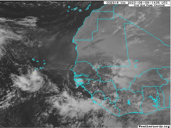
A convectively active low centered south of the Cabo Verde islands, a low that is at best barely identified by models - models that have a challenging time picking up even better developed and even larger systems this far out - continues tracking generally west and staying weak.
There has been some on and off model support for this feature to develop either on its own or once its remnant is effectively absorbed by the larger approaching wave about to exit from Africa behind it.
Collectively, this low, or the merger, does have lukewarm model support for development, with several runs suggesting an ability to sneak in under ridges and getting a little further west. This might be more possible should the feature stay weak for longer, for as a general rule of thumb, Cape Verde hurricanes during an El Niño season should in theory, and so far this year in practice, run into a lot of TUTTS and now also approaching continental trofs that could send them recurving, or even sheared to bits.
This feature is not yet Invest tagged, and hasn't even been included in any NHC TWO products, but soon may be, and the title would be updated accordingly.
Like Lee ahead of it, we would have a very long time to keep an eye on this should it pop.
The lead low located south of the Cabo Verdes in the first post image was Invest tagged 09/10/23 afternoon, 97L.
The trailing wave was Invest tagged 98L as of 09/11/23 2023, centered midday Monday near 11.5N 21.1W.
NHC and the models have not yet resolved which wave becomes dominant, or perhaps even stay separated. It is complicated and until one becomes a T.C. this lounge will consider them as one larger area of lower pressure with embedded meager or small circulations. 09/11/23/7PM EDT - Ciel
TD 15 9/15/23 - Ciel
Edited by cieldumort (Fri Sep 15 2023 02:08 PM)
|
|
0 registered and 3 anonymous users are browsing this forum.
Moderator:
|
Forum Permissions
You cannot start new topics
You cannot reply to topics
HTML is disabled
UBBCode is enabled
|
Rating:
Thread views: 3481
|
|
|
|
|
|
Note: This is
NOT an official page. It is run by weather hobbyists and should not be used as a replacement for official sources.
CFHC's main servers are currently located at
Hostdime.com in Orlando, FL.
Image Server Network thanks to Mike Potts and Amazon Web Services. If you have static file hosting space that allows dns aliasing contact us to help out! Some Maps Provided by:
Great thanks to all who
donated and everyone who uses the site as well.
Site designed for 800x600+ resolution
When in doubt, take the word of the
National Hurricane Center
G