cieldumort
Moderator

Reged:
Posts: 2664
Loc: Austin, Tx
|
 Possible late Oct system in W ATL
Thu Oct 19 2023 03:11 PM
|
|
|


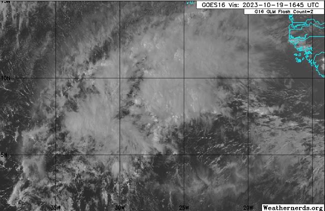
Disturbed weather and broad low pressure associated with the monsoon trof in the far eastern Atlantic has increasing model support for development later this month in the western Atlantic, and in fact much closer to North America than we have seen from most model runs of most other disturbances of late.
Of note, two of the best performing Globals this year, the EURO (ECMWF) and the Canadian (GEM), have been cooking this up, altough substantial location and timing differences remain, not just between these models, but between themselves.
Generally, the Canadian suggests this feature stays weak enough and south enough to threaten the Caribbean as a tropical cyclone by mid to late next week, depending on run, and prefers an almost due west track through the Caribbean
The past few runs from the EURO suggests this feature stays weak and south enough to marginally threaten the Caribbean as maybe a tropical cyclone by late next week, before tracking more to the northwest than west, and putting Cuba and the Bahamas in play the last weekend of the month.
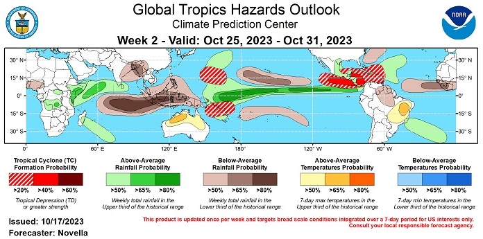
As of today, Thursday Oct 19, there are some subtle hints that a few regions within this broad monsoonal trof may indeed be consolidating into a trackable low, and given the rather consistent model heat coming from the more reliable EURO and Canadian, along with the highlighting from the Climate Prediction Center, we are starting a lounge on this feature at this time, with once again, a long time to watch and plenty of things that could make or break development and track and whether or not this becomes a very short story or something longer.
This feature is not yet Invest tagged. Should it get one, the title will be updated accordingly.
|
|


 Flat
Flat


