Quote: I use the map at Weather Underground since it shows the NHC path along with a satellite and radar overlay: https://www.wunderground.com/wundermap just wish the radar was hi-def like the Radar Scope app.
If anyone has an app or site that provides the line plus hi-def radar let me know.
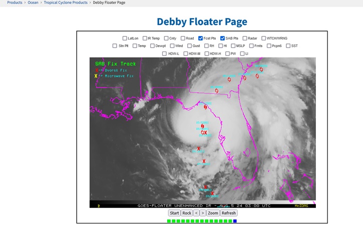
Worth mentioning that OSPO Floaters are back up 04L Floater
I also use Wunderground myself. MyRadar (upgrade) is another viable app for tracking radar against the center line and cone.
0 registered and 2 anonymous users are browsing this forum.
Moderator:
Forum Permissions
You cannot start new topics
You cannot reply to topics
HTML is disabled
UBBCode is enabled
Rating:
Thread views: 33203
Note: This is NOT an official page. It is run by weather hobbyists and should not be used as a replacement for official sources.
CFHC's main servers are currently located at Hostdime.com in Orlando, FL.
Image Server Network thanks to Mike Potts and Amazon Web Services. If you have static file hosting space that allows dns aliasing contact us to help out! Some Maps Provided by:
Great thanks to all who donated and everyone who uses the site as well.
Site designed for 800x600+ resolution
When in doubt, take the word of the National Hurricane Center