Current Radar or Satellite Image

Flhurricane.com - Central Florida Hurricane Center - Tracking Storms since 199531 Years of Hurricanes Without the Hype - Since 1995


Bertha pushing into east Texas. Heavy rain and strong thunderstorms occuring near, along and offshore of central to southeast TX.
Days since last Hurricane Landfall — US Any: 652 (Milton), US Major: 652 (Milton), FL Any: 652 (Milton), FL Major: 652 (Milton)
FlHurricane Atlantic Tropical Cyclone Tracking 🌀 Since 1995
30.0N -96.0W
Wind: 35MPH
Pres: 1008mb
Moving:
Present movement...w or 270 degrees at 14 mph...22 km/h
Click for Storm Spotlight
HypeScale:
5.00
0510
Communication
Storm Data
Content
Follow & Connect


Archives 2020s >> 2024 Forecast Lounge

IsoFlame
Weather Analyst


Reged:
Posts: 414
Loc: One block off the Atlantic Oce...
Re: Central Atlantic Low
      Wed Sep 11 2024 10:06 AM

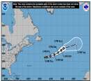
Latest loop showing a core of consolidated, continuous convection steadily tracking west along 15N, approaching 50W has my undivided attention:
92L loop

Could become Gordon sometime next week if the low forecast to form off the Carolinas late in the weekend doesn't get the name first.

--------------------
CoCoRaHS Weather Observer (FL-VL-42) & Surf Forecaster: https://www.surf-station.com/north-florida-surf-forecast-3/

Post Extras Print Post   Remind Me!     Notify Moderator


Entire topic
Subject Posted by Posted on
* Sep 7 92L cieldumortModerator Wed Sep 11 2024 10:06 AM
. * * Re: Central Atlantic Low cieldumortModerator   Sat Sep 07 2024 09:17 PM
. * * Re: Central Atlantic Low IsoFlame   Wed Sep 11 2024 10:06 AM

Extra information
0 registered and 1 anonymous users are browsing this forum.

Moderator:  CFHC, MikeC, Ed Dunham, Colleen A., Atricks, danielw, Clark, Christine H, RedingtonBeachGuy, SkeetoBite, Bloodstar, tpratch, typhoon_tip, cieldumort, Jackie M, Wigeon, Hank Buck 


Forum Permissions
      You cannot start new topics
      You cannot reply to topics
      HTML is disabled
      UBBCode is enabled

Rating:
Thread views: 4124

Rate this thread

Jump to