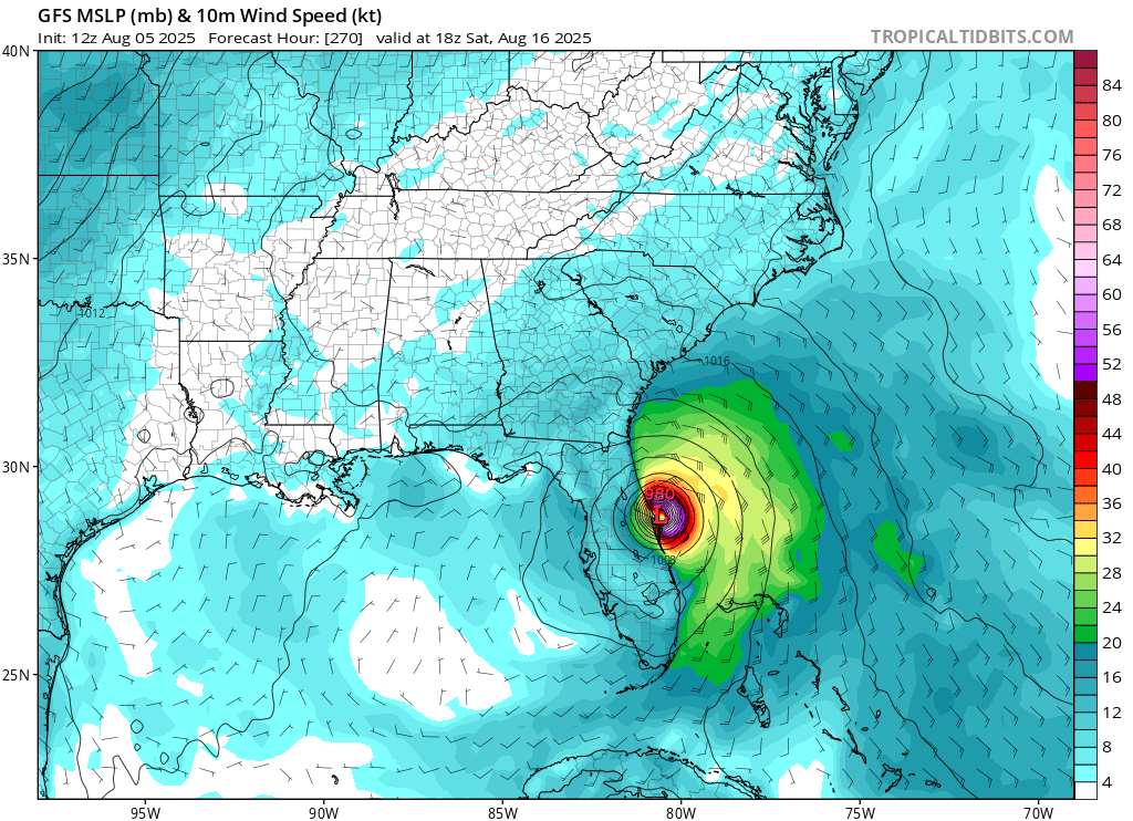
Interestingly the 12z GFS has shifted back west toward Cape Canaveral
Icon shifted to be SSW of Bermuda, but the 12z Euro still keeps it east of Bermuda. Euro still likes the followup wave better and
My guess for the track of this area is still somewhere in the middle, which may make it get closer to Bermuda (but not much... still safely east), but very unlikely to get to the US mainland.
The followup behind this wave is the one the Euro really likes. However, MDR may be a little more favorable overall on some parameters -- but not all, it's still not enough to support something larger, although it makes it more likely for later when the waves get further west.
Both major models show a follow able area on Friday, which is probably the day the models start to reconcile a bit more.
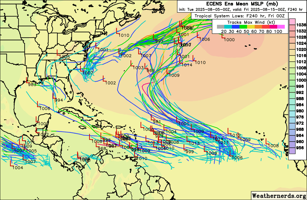
Ensembles spell out the more likely paths I think
The gfs ensembes (GEFS) has also backed off quite a bit on the idea of the first wave making all the way west. It's also making me watch the area over the Bahamas now. (See the ensemble members that start in the Gulf) The wave east of the wave in the outlook is still the favored one by the euro set.
0 registered and 20 anonymous users are browsing this forum.
Moderator:
Forum Permissions
You cannot start new topics
You cannot reply to topics
HTML is disabled
UBBCode is enabled
Rating:
Thread views: 40430
Note: This is NOT an official page. It is run by weather hobbyists and should not be used as a replacement for official sources.
CFHC's main servers are currently located at Hostdime.com in Orlando, FL.
Image Server Network thanks to Mike Potts and Amazon Web Services. If you have static file hosting space that allows dns aliasing contact us to help out! Some Maps Provided by:
Great thanks to all who donated and everyone who uses the site as well.
Site designed for 800x600+ resolution
When in doubt, take the word of the National Hurricane Center


 Flat
Flat