MikeC
Admin
Reged:
Posts: 4835
Loc: Orlando, FL
|
 Erin Forecast Lounge
Sat Aug 09 2025 06:06 AM
|
|
|
This is for the new potential long track system exiting the African coast right now. If it develops, which it could do soon (according to the GFS) or later in the week (Euro) would likely be the candidate for the name Erin. 1995's Erin was the first hurricane covered by flhurricane (before it was flhurricane).
The lounge topics are to lightly discuss storms, speculation, gut feelings, and the like. They are meant for folks to do a deep dive or discuss what's going on and speculate, not really forecast. Mixing the two creates hype which we avoid. Front page is more for observations and official forecast, this is for more about the future, aka educated guessing, but guessing none the less. Models, particularly long range one fit speculation, they are not the final source, they do provide hints to the pattern and highlight elements, but should not be taken at face value.
The 6z GFS starts it off pretty quickly, developing it into a tropical storm by Monday evening. It's still moving out.
The earlier few runs of the GFS were similar, the euro doesn't really develop the system until much later, next Saturday. My guess it's somewhere in between either extreme.
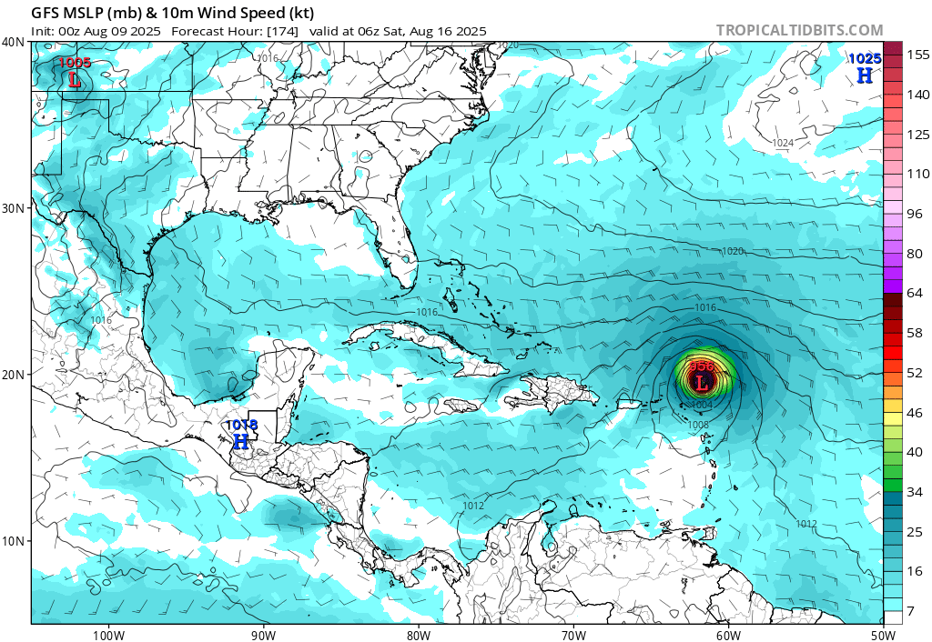
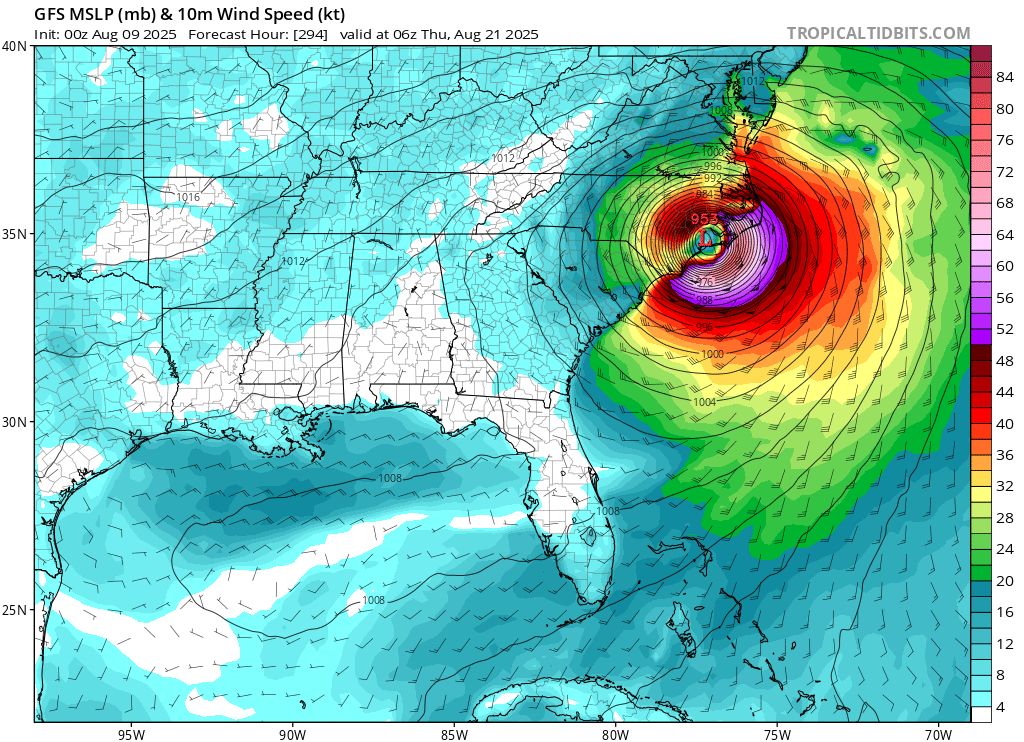
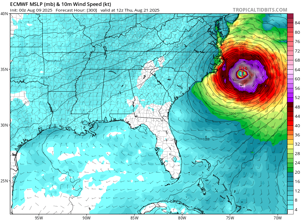
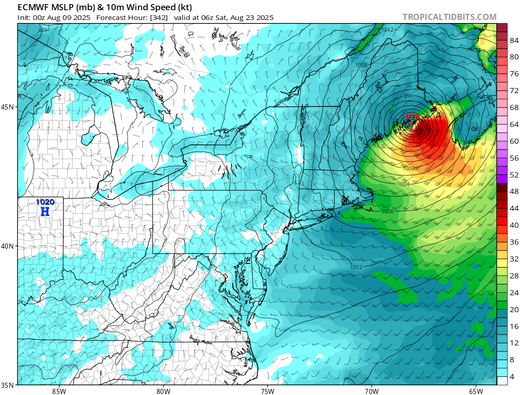
0z GFS made landfall in eastern North Carolina, after getting close, but not over the Caribbean islands, and getting into parts of the Bahamas. The euro avoids both of those, and the Carolina coastline, but makes landfall in Massachusetts and again in Maine/Nova Scotia. CMC avoids both.
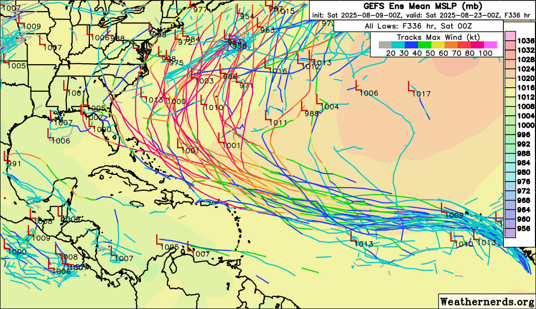
The good news is that the majority of ensembles of both the GFS and Euro keep it offshore, however, it's not as much of majority as we would like. This system will likely need to be closely watched most of its lifetime for the Caribbean, Bahamas, Bermuda and the US/Canada.
0z gfs at closest approach to Caribbean Islands
0z GFS Bahamas
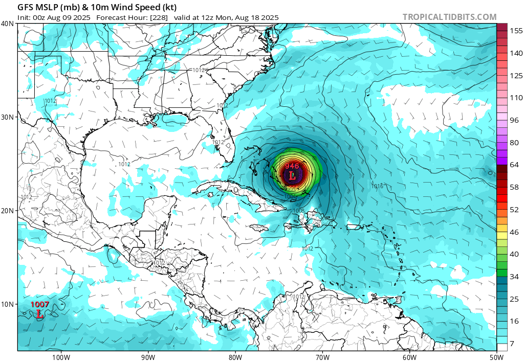
0z GFS North Carolina:
0z Euro Closest approach to North Carolina:
0z Euro Massachusetts Landfall
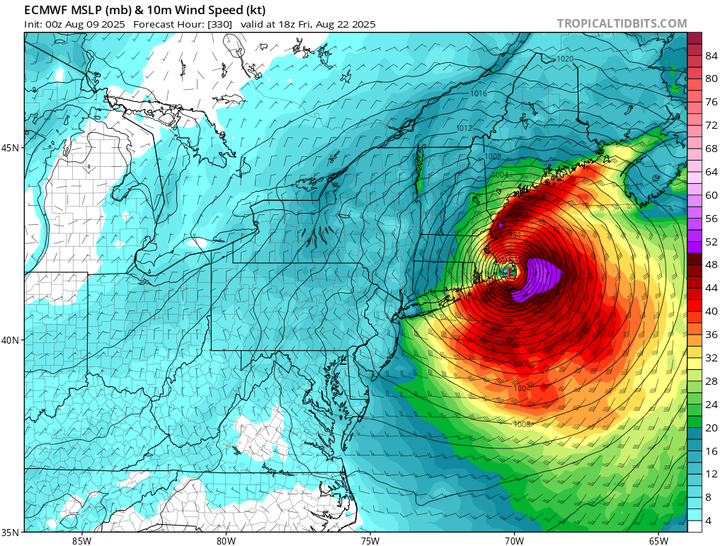
0z Euro Maine Landfall:
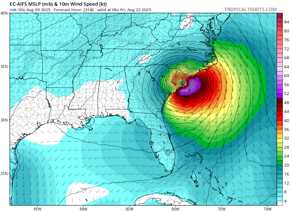
0z Euro AI South Carolina Landfall
0z Euro Ensembles
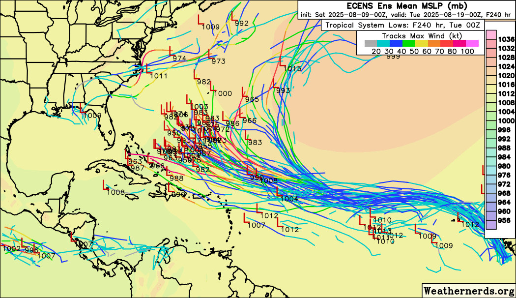
0z GFS Ensembles (Watch how these trend over the days)
Sometime's we'll do a deep dive in a model run or two, but not all of them here. Models get more inaccurate the further out in time it is, you look for trends, persistence/consistency, and agreement between ensembles and individual runs the most. 5 day is decent, 10 day mark is ok, beyond that it gets rough. 3 day is better, but even not perfect.
Bottom line, the most likely outcome is for this system to stay offshore.
At 10:10AM Aug 11, NHC put out a Special Update that 97L would be upgraded directly to Tropical Storm Erin with 45 MPH max sustained winds with Advisories to begin at 11, and the title has been updated accordingly.
-Ciel
Edited by cieldumort (Mon Aug 11 2025 10:50 AM)
|
|


 Flat
Flat


