New Article: CSU releases 2026 season numbers, slightly below average. https://flhurricane.com
Days since last Hurricane Landfall —
US Any:
555 (Milton),
US Major:
555 (Milton),
FL Any:
555 (Milton),
FL Major:
555 (Milton)
cieldumort
Moderator
Reged:
Posts: 2664
Loc: Austin, Tx
|
Humberto Lounge
Mon Sep 22 2025 01:22 PM
|
|
|

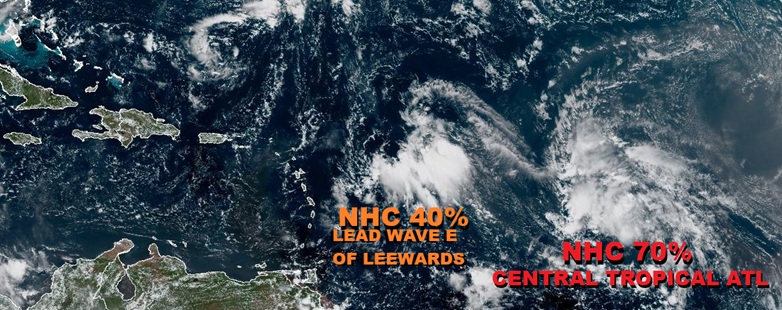
A robust wave presently located in the Tropical Atlantic about halfway between the Lesser Antilles and the Cabo Verde Islands has strong but conflicting model support for development, with most models very warm on its chances, but the GFS cool as ice. Ultimately, a lot of what happens with this wave may be influenced by the trends from the lead wave ahead of it, presently located east of the Leewards.
Considering that most models are hot on this wave, that NHC is also giving it a 70% chance of TC formation, and a future track that could follow Gabrielle and even left (west) of where Gabrielle has gone, thereby possibly putting Bermuda in play, we are starting a Lounge on this system at this time. Invest tag TBD.
The wave in the Tropical Atlantic we have been tracking was Invest tagged overnight, 93L, and the title has been updated accordingly 2025-09-23 06:00 14.2N 47.6W 20 KTS
Humberto Sep 24. The title has been updated accordingly. 2025-09-24 18:00 19.8N 54.5W 35 KTS Ciel
Edited by cieldumort (Wed Sep 24 2025 05:03 PM)
|
|
0 registered and 27 anonymous users are browsing this forum.
Moderator:
|
Forum Permissions
You cannot start new topics
You cannot reply to topics
HTML is disabled
UBBCode is enabled
|
Rating:
Thread views: 4478
|
|
|
|
|
|
Note: This is
NOT an official page. It is run by weather hobbyists and should not be used as a replacement for official sources.
CFHC's main servers are currently located at
Hostdime.com in Orlando, FL.
Image Server Network thanks to Mike Potts and Amazon Web Services. If you have static file hosting space that allows dns aliasing contact us to help out! Some Maps Provided by:
Great thanks to all who
donated and everyone who uses the site as well.
Site designed for 800x600+ resolution
When in doubt, take the word of the
National Hurricane Center
G