Current Radar or Satellite Image

Flhurricane.com - Central Florida Hurricane Center - Tracking Storms since 199531 Years of Hurricanes Without the Hype - Since 1995


Watching two areas: Gulf-Southwest Atlantic and also the far eastern Atlantic.
Days since last Hurricane Landfall — US Any: 645 (Milton), US Major: 645 (Milton), FL Any: 645 (Milton), FL Major: 645 (Milton)
FlHurricane Atlantic Tropical Cyclone Tracking 🌀 Since 1995
None
HypeScale:
0.20
0510
Communication
Storm Data
Content
Follow & Connect


News Talkback >> 2026 News Talkbacks

cieldumortModerator
Moderator


Reged:
Posts: 2707
Loc: Austin, Tx
Re: Tropical Storm Arthur
      Wed Jun 17 2026 04:44 PM

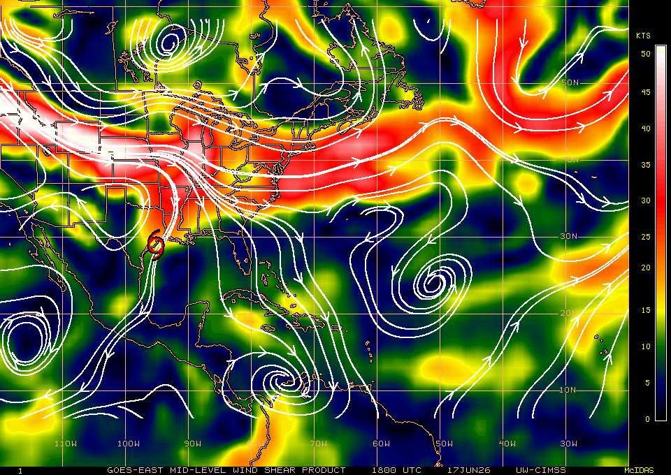
Arthur appears to getting tugged east, towards and closer to if not possibly, ultimately into, the deeper convection.

CIMSS analyzes what is possibly a sweet pocket of much lower shear to the east. If the center reforms into the deep convection and if CIMSS is correct, that could easily open the hurricane door.


Post Extras Print Post   Remind Me!     Notify Moderator


Entire topic
Subject Posted by Posted on
* Tropical Storm Arthur cieldumortModerator Wed Jun 17 2026 04:44 PM
. * * Re: Tropical Storm Arthur cieldumortModerator   Wed Jun 17 2026 04:44 PM
. * * Re: Tropical Storm Arthur CFHCAdministrator   Wed Jun 17 2026 04:36 PM
. * * Re: Tropical Storm Arthur cieldumortModerator   Wed Jun 17 2026 01:16 PM
. * * Re: Tropical Storm Arthur cieldumortModerator   Wed Jun 17 2026 11:49 AM

Extra information
0 registered and 0 anonymous users are browsing this forum.

Moderator:  CFHC, MikeC, Ed Dunham, Colleen A., Atricks, danielw, Clark, Christine H, RedingtonBeachGuy, SkeetoBite, Bloodstar, tpratch, typhoon_tip, cieldumort, Jackie M, Wigeon, Hank Buck 


Forum Permissions
      You cannot start new topics
      You cannot reply to topics
      HTML is disabled
      UBBCode is enabled

Rating:
Thread views: 1664

Rate this thread

Jump to