Current Radar or Satellite Image

Flhurricane.com - Central Florida Hurricane Center - Tracking Storms since 199531 Years of Hurricanes Without the Hype - Since 1995


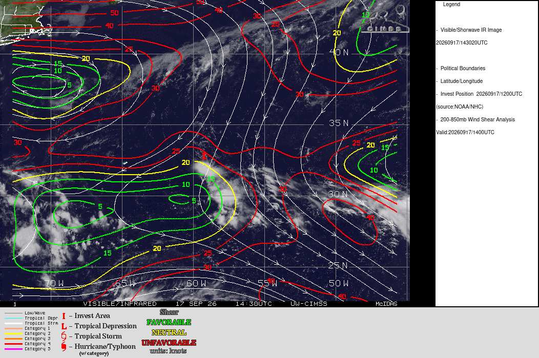
98L is struggling with high shear while east of Bermuda
Days since last Hurricane Landfall — US Any: 707 (Milton), US Major: 707 (Milton), FL Any: 707 (Milton), FL Major: 707 (Milton)
FlHurricane Atlantic Tropical Cyclone Tracking 🌀 Since 1995
HypeScale:
1.30
0510
Communication
Storm Data
Content
Follow & Connect


General Discussion >> 2026 Forecast Lounge

cieldumortModerator
Moderator


Reged:
Posts: 2864
Loc: Austin, Tx
Re: Invest 98L - Possible Bermuda Impacts
      Thu Sep 17 2026 11:55 AM

25-30 knots of northeasterly shear have decapitated 98L today further allowing in copious dry air, and models have drastically reduced near-term development chances, unsurprisingly.

While development potential in the next 48 hours is likely much lower now, models suggest that the Invest still hangs around for quite a while and conditions could become more favorable heading into next week - if forecasts verify.


Post Extras Print Post   Remind Me!     Notify Moderator


Entire topic
Subject Posted by Posted on
* Invest 98L - Possible Bermuda Impacts cieldumortModerator Thu Sep 17 2026 11:55 AM
. * * Re: Invest 98L - Possible Bermuda Impacts cieldumortModerator   Thu Sep 17 2026 11:55 AM
. * * Re: Invest 98L - Possible Bermuda Impacts cieldumortModerator   Wed Sep 16 2026 09:41 PM

Extra information
0 registered and 0 anonymous users are browsing this forum.

Moderator:  CFHC, MikeC, Ed Dunham, Colleen A., Atricks, danielw, Clark, Christine H, RedingtonBeachGuy, SkeetoBite, Bloodstar, tpratch, typhoon_tip, cieldumort, Jackie M, Wigeon, Hank Buck 


Forum Permissions
      You cannot start new topics
      You cannot reply to topics
      HTML is disabled
      UBBCode is enabled

Rating:
Thread views: 240

Rate this thread

Jump to