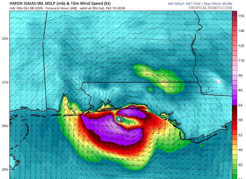
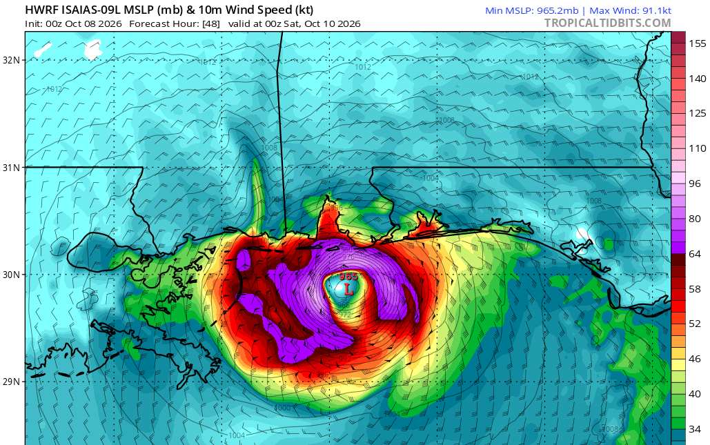
The latest 0z hurricane model runs are rolling in. They have now assimilated loads of recon data.
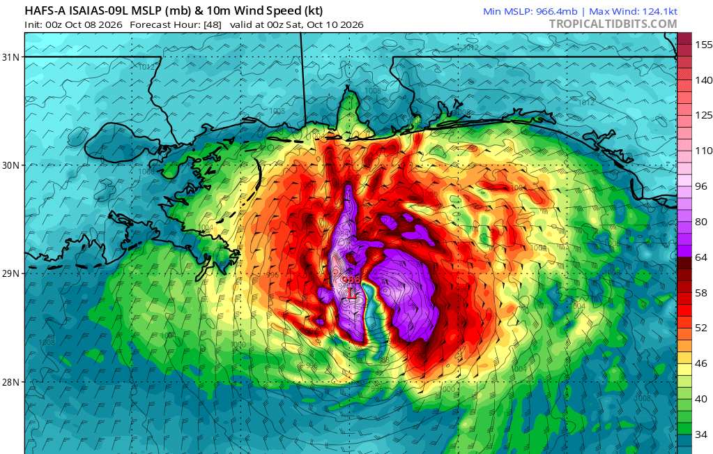
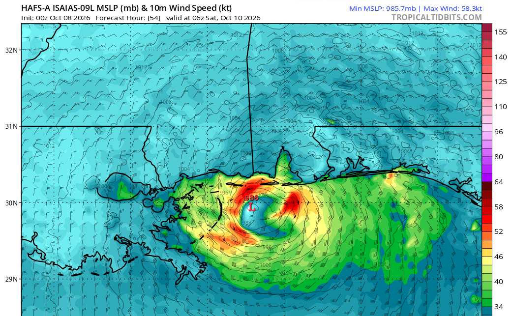
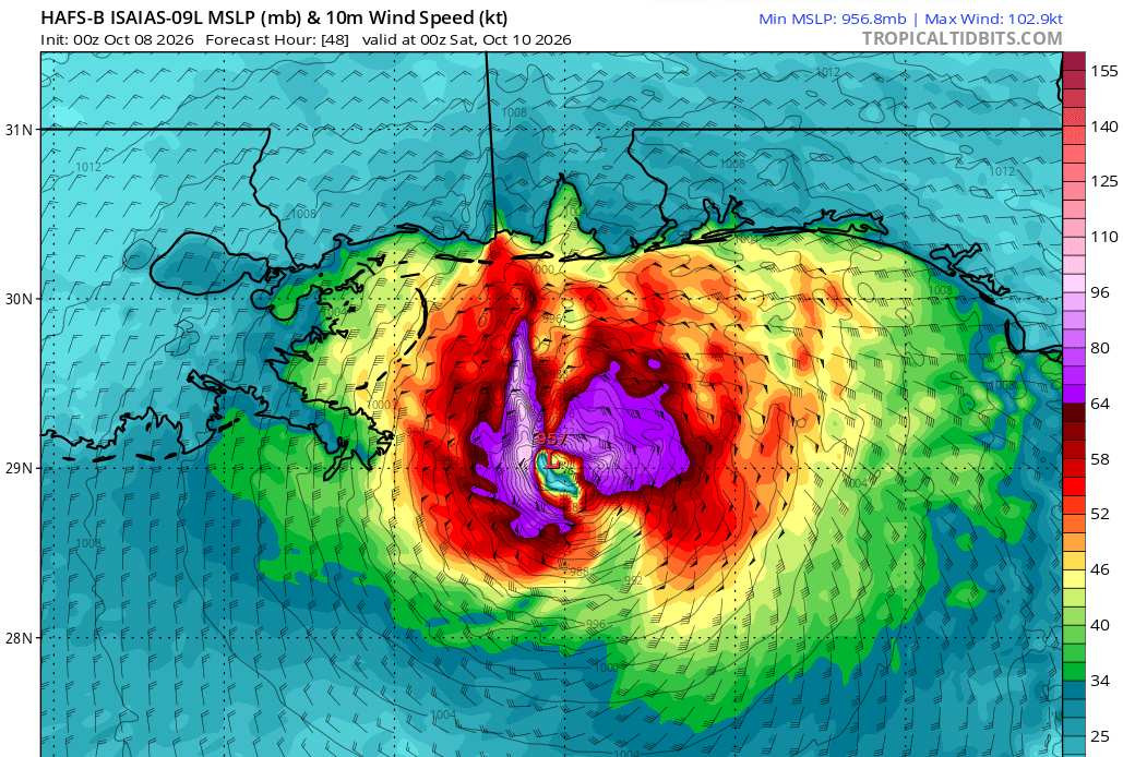
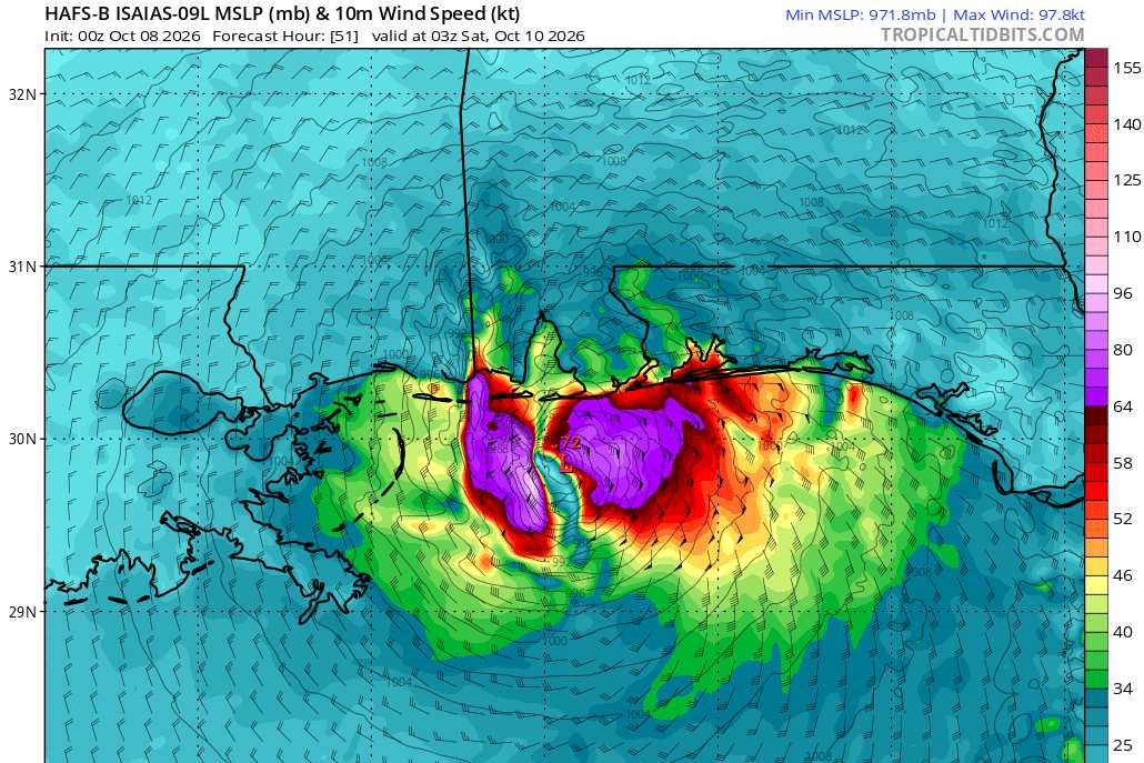
Here are some 10m wind screenshots. Credits: TropicalTidbits
The first image is going to be 48 hours out from run initialization. The second image, if there is one, is of a given model's forecast for as close to landfall time as can be possibly shown here.
HAFS-A Cat 4 at 10/0z
Rapidly weakening heading into landfall. Possibly upper-end Tropical Storm *at* landfall per this model run.
HAFS-B Cat 3 at 10/0z
Weakening trend. Maybe Cat 2 heading into landfall.
HMON Landfall actually occurring roughly around 48 hours out (10/0z). Possibly higher-end Cat 2 into landfall.
HWRF Also with a landfall right around 48 hours out from initialization (10/0z). Also possibly Cat 2 into landfall.
All in all, there is actually a lot of consensus with these four models.




 Previous
 Index
Index
 Next
Next
 Flat
Flat

 Re: Isaias Lounge
 Edit
Edit
 Reply
Reply
 Quote
Quote