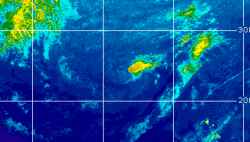
Current Radar or Satellite Image

Flhurricane.com - Central Florida Hurricane Center - Tracking Storms since 199531 Years of Hurricanes Without the Hype - Since 1995


Subropical to Tropical development becoming more likely over the weekend into next week off the southeast to east coast. Could head inland.
Days since last Hurricane Landfall — US Any: 40 (Isaias), US Major: 770 (Milton), FL Any: 40 (Isaias), FL Major: 770 (Milton)
FlHurricane Atlantic Tropical Cyclone Tracking 🌀 Since 1995
None
HypeScale:
0.66
0510
Communication
Storm Data
Content
Follow & Connect


General Discussion >> 2026 Forecast Lounge

IsoFlame
Weather Analyst


Reged:
Posts: 421
Loc: One block off the Atlantic Oce...
Re: Modeled Gulf Stream Hybrid
      Wed Nov 18 2026 08:42 PM

3 inches of rain last night, 5 inches today (as of 8pm). Sustained wind in 20-30 mph range with wind gusts of 50 mph in training rain bands off the Atlantic. If Kyle does form late in the week, it will hopefully be far enough offshore not to add to the flooding rains we are having in coastal Volusia.

--------------------
CoCoRaHS Weather Observer (FL-VL-42) & Surf Forecaster: https://www.surf-station.com/north-florida-surf-forecast-3/

Post Extras Print Post   Remind Me!     Notify Moderator


Entire topic
Subject Posted by Posted on
* Modeled Gulf Stream Hybrid cieldumortModerator Wed Nov 18 2026 08:42 PM
. * * Re: Modeled Gulf Stream Hybrid cieldumortModerator   Wed Nov 18 2026 03:12 AM
. * * Re: Modeled Gulf Stream Hybrid IsoFlame   Wed Nov 18 2026 08:42 PM

Extra information
0 registered and 0 anonymous users are browsing this forum.

Moderator:  CFHC, MikeC, Ed Dunham, Colleen A., Atricks, danielw, Clark, Christine H, RedingtonBeachGuy, SkeetoBite, Bloodstar, tpratch, typhoon_tip, cieldumort, Jackie M, Wigeon, Hank Buck 


Forum Permissions
      You cannot start new topics
      You cannot reply to topics
      HTML is disabled
      UBBCode is enabled

Rating:
Thread views: 148

Rate this thread

Jump to