Current Radar or Satellite Image

Flhurricane.com - Central Florida Hurricane Center - Tracking Storms since 199531 Years of Hurricanes Without the Hype - Since 1995


Invest 91L increasingly likely to develop. Watches and/or Warnings may be Issued by Monday.
Days since last Hurricane Landfall — US Any: 647 (Milton), US Major: 647 (Milton), FL Any: 647 (Milton), FL Major: 647 (Milton)
FlHurricane Atlantic Tropical Cyclone Tracking 🌀 Since 1995
HypeScale:
1.65
0510
Communication
Storm Data
Content
Follow & Connect


News Talkback >> 2002 News Articles and Talkback

Anonymous
Unregistered


Re: Tropical Storm FAY
      Fri Sep 06 2002 10:31 PM

I'm trying to figure out whats going on with Fay. Steve Lyons says shes moving toward the coast, I don't know I guess his opinion is as good as any at this point. Maybe part of it is, but if you look at the shortwave IR

http://www.ssd.noaa.gov/PS/TROP/DATA/RT/float-ir2-loop.html

you can pick out a circulation centered on about 28/95 or so. It will be interesting to see if he convection reforms tonight around this. Pressures still seem to be lowering so I'm not quite ready to say it's over yet. Recon will be there soon so maybe that will answer a few questions.

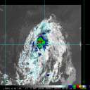
Frank P and Steve what do ya think ?

Houstontracker

Post Extras Print Post   Remind Me!     Notify Moderator


Entire topic
Subject Posted by Posted on
* Tropical Storm FAY CFHCAdministrator Fri Sep 06 2002 10:31 PM
. * * Re: Tropical Storm FAY Anonymous   Fri Sep 06 2002 10:55 PM
. * * Re: Tropical Storm FAY Anonymous   Fri Sep 06 2002 06:22 PM
. * * Re: Tropical Storm FAY Anonymous   Fri Sep 06 2002 10:31 PM
. * * Re: Tropical Storm FAY Frank P   Fri Sep 06 2002 11:01 PM
. * * Tracker... Anonymous   Fri Sep 06 2002 11:37 PM
. * * 07z look HanKFranK   Sat Sep 07 2002 03:48 AM
. * * Re: 07z look troy2   Sat Sep 07 2002 12:33 PM
. * * Re: Kevin   Sat Sep 07 2002 12:46 PM
. * * Re: Anonymous   Sat Sep 07 2002 02:10 PM
. * * 3 systems with TC formation in the comming days Cycloneye   Sat Sep 07 2002 09:00 AM
. * * six hour later comments HanKFranK   Sat Sep 07 2002 09:11 AM
. * * Tropical thoughts Anonymous   Sat Sep 07 2002 09:38 AM
. * * Last post was from me. n/t Kevin   Sat Sep 07 2002 09:39 AM
. * * TD#7 has formed in central atlantic Cycloneye   Sat Sep 07 2002 10:08 AM
. * * Shear Monster Struck Again Frank P   Sat Sep 07 2002 10:51 AM
. * * Interesting Bastardi quote this morning.. Anonymous   Sat Sep 07 2002 12:05 PM
. * * NHC reasoning TOTALLY beyond me... Kevin   Sat Sep 07 2002 12:21 PM
. * * Re: Tropical Storm FAY J.J.   Fri Sep 06 2002 04:37 PM
. * * Re: JJ's post Anonymous   Fri Sep 06 2002 04:44 PM
. * * PS- Eduoard remnants Anonymous   Fri Sep 06 2002 04:46 PM
. * * Will Fay reach cane status? Cycloneye   Fri Sep 06 2002 05:42 PM
. * * Re: Tropical Storm FAY troy2   Fri Sep 06 2002 02:39 PM
. * * Re: Tropical Storm FAY troy2   Fri Sep 06 2002 02:30 PM
. * * Re: GFDL== Boguscane City Anonymous   Fri Sep 06 2002 03:27 PM
. * * Wait a minute! It's EDOUARD! Steve   Fri Sep 06 2002 02:34 PM
. * * Hey troy check out the 120 hour mrf Hurricaneman   Fri Sep 06 2002 03:44 PM
. * * Re: Tropical Storm FAY troy2   Fri Sep 06 2002 11:02 AM
. * * Re: Tropical Storm FAY Anonymous   Fri Sep 06 2002 11:49 AM
. * * fay on down HanKFranK   Fri Sep 06 2002 01:01 PM
. * * Re: fay on down Anonymous   Fri Sep 06 2002 02:19 PM
. * * Re: fay on down Anonymous   Fri Sep 06 2002 03:10 PM
. * * Re:Fay Anonymous   Fri Sep 06 2002 03:31 PM
. * * Re:Fay Steve   Fri Sep 06 2002 03:47 PM
. * * Nice little rain band coming through... Steve   Fri Sep 06 2002 02:30 PM
. * * Re: Tropical Storm FAY Anonymous   Fri Sep 06 2002 10:26 AM
. * * FAY Anonymous   Fri Sep 06 2002 10:52 AM

Extra information
0 registered and 378 anonymous users are browsing this forum.

Moderator:  MikeC, Ed Dunham, danielw 


Forum Permissions
      You cannot start new topics
      You cannot reply to topics
      HTML is disabled
      UBBCode is enabled

Rating:
Thread views: 18008

Rate this thread

Jump to