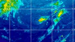
Current Radar or Satellite Image

Flhurricane.com - Central Florida Hurricane Center - Tracking Storms since 199531 Years of Hurricanes Without the Hype - Since 1995


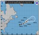
Josephine forms from 93L. Forecast to become a hurricane-force fish spinner. Watching off SE for potential new Area of Interest this weekend.
Days since last Hurricane Landfall — US Any: 14 (Isaias), US Major: 744 (Milton), FL Any: 14 (Isaias), FL Major: 744 (Milton)
FlHurricane Atlantic Tropical Cyclone Tracking 🌀 Since 1995
39.2N 67.3W
Wind: 65MPH
Pres: 988mb
Moving:
Present movement...ne or 45 degrees at 12 mph...19 km/h
Click for Storm Spotlight
HypeScale:
0.05
0510
Communication
Storm Data
Content
Follow & Connect


Weather Bloggers >> Resident Meteorologist Discussions

wxman007
Meteorologist


Reged:
Posts: 617
Loc: Tuscaloosa, AL
Looking South...
      Tue Jun 28 2005 11:46 AM

Looking south at the Bay of Campeche, we seem some pretty good clustering of thunderstorms down there. Upper level conditions are getting a little more favorable for some development over the next few days, although with the close proximity to land, it looks like this would be a Mexican storm if anything does try to develop. It is worth keeping our eyes on just in case. It wouldn't surprise me to see a recon tasking down there in today's Plan of the Day, if trends continue.

--------------------
Jason Kelley


Post Extras Print Post   Remind Me!     Notify Moderator


Entire topic
Subject Posted by Posted on
* Looking South... wxman007 Tue Jun 28 2005 11:46 AM

Extra information
0 registered and 0 anonymous users are browsing this forum.

Moderator:  Ed Dunham, danielw, Clark, tpratch, typhoon_tip 


Forum Permissions
      You cannot start new topics
      You cannot reply to topics
      HTML is disabled
      UBBCode is enabled

Rating:
Thread views: 3876

Rate this thread

Jump to