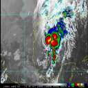
Current Radar or Satellite Image

Flhurricane.com - Central Florida Hurricane Center - Tracking Storms since 199531 Years of Hurricanes Without the Hype - Since 1995


Invest 97L organizing in the northern Gulf. Louisiana and Texas should pay close attention. Advisories on FIVE may begin as soon as later today.
Days since last Hurricane Landfall — US Any: 690 (Milton), US Major: 690 (Milton), FL Any: 690 (Milton), FL Major: 690 (Milton)
FlHurricane Atlantic Tropical Cyclone Tracking 🌀 Since 1995
HypeScale:
1.75
0510
Communication
Storm Data
Content
Follow & Connect


General Discussion >> Hurricane Ask/Tell

ClarkModerator
Meteorologist


Reged:
Posts: 1710
Re: Brief Thoughts on Irene
      Thu Aug 11 2005 01:58 PM

With baroclinic (e.g. midlatitude systems) energetics, you get kinetic energy extracted from the potential energy of the mean flow (which itself has two components -- internal potential energy and that from gravity). However, not all potential energy can be converted over to kinetic energy...in fact, the percentage of such is pretty low. Even less of the total potential energy can be converted over to available potential energy.

Getting to the math behind all of this is very complex...it's entry-level graduate dynamics in meteorology. But, skipping that, the conversion term to get between potential and kinetic energy is directly related to the thermal wind, which itself is a measure of the vertical difference in the winds between two levels, and vertical motion processes. In that respect, the thermal wind is not a true wind shear, but is in many respects similar to one. Generation of potential energy that can be converted to kinetic energy comes out of heating processes. Ultimately, the kinetic energy goes back to potential energy as the system evolves and matures, leading to dissipation.

The big thing about weather systems is that they occur to restore stability to an unstable situation. They grow out of instability -- it is required to even get to this whole debate on energetics -- but serve as facilitators to return the atmosphere to a stable state.

--------------------
Current Tropical Model Output Plots
(or view them on the main page for any active Atlantic storms!)

Post Extras Print Post   Remind Me!     Notify Moderator


Entire topic
Subject Posted by Posted on
* Brief Thoughts on Irene Ryan Thu Aug 11 2005 01:58 PM
. * * Re: Brief Thoughts on Irene Big Kahuna   Tue Aug 09 2005 08:46 AM
. * * Re: Brief Thoughts on Irene Ryan   Tue Aug 09 2005 11:15 AM
. * * Re: Brief Thoughts on Irene ClarkModerator   Tue Aug 09 2005 01:40 PM
. * * Re: Brief Thoughts on Irene Lysis   Tue Aug 09 2005 04:16 PM
. * * Re: Brief Thoughts on Irene ClarkModerator   Wed Aug 10 2005 12:26 AM
. * * Re: Brief Thoughts on Irene Lysis   Wed Aug 10 2005 06:01 PM
. * * Re: Brief Thoughts on Irene ClarkModerator   Wed Aug 10 2005 06:06 PM
. * * Re: Brief Thoughts on Irene Lysis   Wed Aug 10 2005 06:29 PM
. * * Re: Brief Thoughts on Irene ClarkModerator   Wed Aug 10 2005 06:38 PM
. * * Re: Brief Thoughts on Irene Lysis   Wed Aug 10 2005 06:44 PM
. * * Re: Brief Thoughts on Irene ClarkModerator   Thu Aug 11 2005 01:58 PM
. * * Re: Brief Thoughts on Irene ClarkModerator   Mon Aug 08 2005 11:26 PM

Extra information
0 registered and 0 anonymous users are browsing this forum.

Moderator:  CFHC, Ed Dunham, Colleen A., danielw, Clark, RedingtonBeachGuy, Bloodstar, tpratch, typhoon_tip, cieldumort 


Forum Permissions
      You cannot start new topics
      You cannot reply to topics
      HTML is disabled
      UBBCode is enabled

Rating:
Thread views: 11755

Rate this thread

Jump to