Current Radar or Satellite Image

Flhurricane.com - Central Florida Hurricane Center - Tracking Storms since 199531 Years of Hurricanes Without the Hype - Since 1995


Hurricane Warning issued for the Big Island. Life-threatening flooding and mudslides are likely in addition to damaging winds, surge and surf.
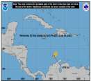
Days since last Hurricane Landfall — US Any: 673 (Milton), US Major: 673 (Milton), FL Any: 673 (Milton), FL Major: 673 (Milton)
FlHurricane Atlantic Tropical Cyclone Tracking 🌀 Since 1995
39.4N -36.8W
Wind: 30MPH
Pres: 1018mb
Moving:
Present movement...ne or 55 degrees at 16 mph...26 km/h
Click for Storm Spotlight
Invest 92LClick for Invest Information from CIMSS
Invest 94LClick for Invest Information from CIMSS
HypeScale:
5.50
0510
Communication
Storm Data
Content
Follow & Connect


News Talkback >> 2005 Storm Forum

reasonmclucus
Verified CFHC User


Reged:
Posts: 17
Loc: Kansas
Re: tracking the high pressure system is the key....
      Wed Sep 21 2005 02:33 PM

I believe it depends in part on how strong the high pressure system is. Air moves clockwise around a high pressure system. A high pressure systen would tend to move a hurricane along its southern and western sides. I don't recall the location of high pressure systems during Katrina, but I do recall noticing clouds moving to the south in the area west of Louisiana which if resulting from high pressure would indicate it was west of La. There was also westward movement across Fl. which could indicate a high pressure system to its north.

Prior to Katrina a series of cold fronts had moved into the central plains and stalled there. One of them may have continued into Texas just prior to katrina hitting New Orleans.

I recall once reading that one of the "benefits" of hurricanes is that they can affect high pressure systems that tend to keep land temperatures and divert rainfall elsewhere.

there is a good site for following hurricanes at

http://www.wunderground.com/tropical/tracking/at200518_5day.html


the site includes a page that shows the results of various computer projections which are now coming closer to agreeing on a path that would indicate landfall roughly between Houston and San Antonio.

--------------------
Almost only counts in horseshoes, hand grenades and hurricanes.


Edited by reasonmclucus (Wed Sep 21 2005 02:38 PM)

Post Extras Print Post   Remind Me!     Notify Moderator


Entire topic
Subject Posted by Posted on
* tracking the high pressure system is the key.... sgruv Wed Sep 21 2005 02:33 PM
. * * Re: tracking the high pressure system is the key.... Margie   Sun Oct 02 2005 12:35 AM
. * * Re: tracking the high pressure system is the key.... reasonmclucus   Wed Sep 21 2005 02:33 PM
. * * Re: tracking the high pressure system is the key.... Tazmanian93   Wed Sep 21 2005 10:43 AM
. * * Re: tracking the high pressure system is the key.... sgruv   Wed Sep 21 2005 10:34 AM
. * * Re: tracking the high pressure system is the key.... Clark   Wed Sep 21 2005 03:23 PM
. * * Re: tracking the high pressure system is the key.... SMOKE   Thu Sep 22 2005 06:27 AM

Extra information
0 registered and 4 anonymous users are browsing this forum.

Moderator:  MikeC, Ed Dunham, danielw 


Forum Permissions
      You cannot start new topics
      You cannot reply to topics
      HTML is disabled
      UBBCode is enabled

Rating:
Thread views: 12375

Rate this thread

Jump to