Flhurricane.com - Central Florida Hurricane Center - Tracking Storms since 199531 Years of Hurricanes Without the Hype - Since 1995
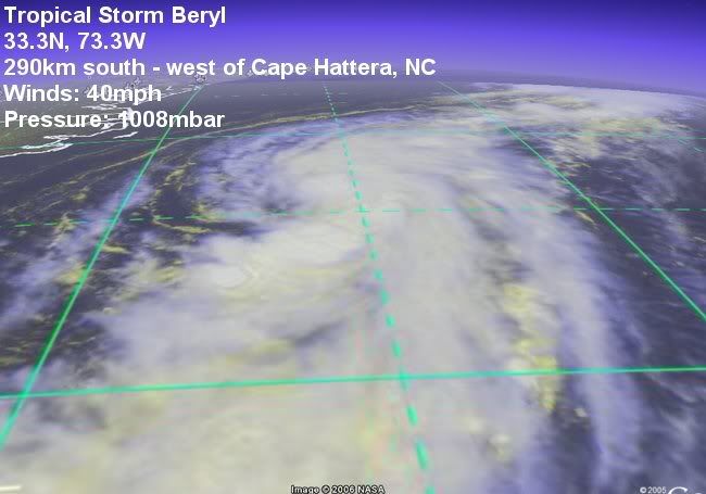
BERTHA ATTEMPTING TO JUMP BACK OFFSHORE SOUTH OF LOUISIANA WED NIGHT. Tropical Storm Warning issued west of Cameron, LA to Sargent, TX


 Flat
Flat