
Current Radar or Satellite Image

Flhurricane.com - Central Florida Hurricane Center - Tracking Storms since 199531 Years of Hurricanes Without the Hype - Since 1995


TROPICAL STORM MOKE LIKELY TO BRING HEAVY RAINFALL AND GUSTY WINDS TO PORTIONS OF THE HAWAIIAN ISLANDS THIS WEEKEND AND EARLY NEXT WEEK
Days since last Hurricane Landfall — US Any: 683 (Milton), US Major: 683 (Milton), FL Any: 683 (Milton), FL Major: 683 (Milton)
FlHurricane Atlantic Tropical Cyclone Tracking 🌀 Since 1995
HypeScale:
2.25
0510
Communication
Storm Data
Content
Follow & Connect


General Discussion >> Other Weather Events

bob3d
Weather Hobbyist


Reged:
Posts: 65
Loc: Pasco County, Florida
Re: Thunderstorm over Miami
      Sun Sep 09 2007 08:41 AM

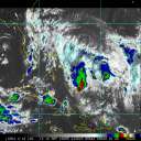
An Upper Level Low is destabilizing the atmosphere south of the Florida Peninsula. The area is expected to lift north and continue to keep Florida in a higher than "normal" rain pattern over the next few days. It is not a tropical LLC. Expect a few bad thunderstorms throughout the central and southern Florida. It appears you were at the right place at the right time to experience a storm spawned by this low.

--------------------
bob
Time in West Central Florida: 52 years

Post Extras Print Post   Remind Me!     Notify Moderator


Entire topic
Subject Posted by Posted on
* Thunderstorm over Miami StrmTrckrMiami Sun Sep 09 2007 08:41 AM
. * * Re: Thunderstorm over Miami bob3d   Sun Sep 09 2007 08:41 AM

Extra information
0 registered and 0 anonymous users are browsing this forum.

Moderator:  CFHC, Ed Dunham, Colleen A., danielw, Clark, RedingtonBeachGuy, SkeetoBite, Bloodstar, tpratch, typhoon_tip, cieldumort 


Forum Permissions
      You cannot start new topics
      You cannot reply to topics
      HTML is enabled
      UBBCode is enabled

Rating:
Thread views: 5890

Rate this thread

Jump to