Current Radar or Satellite Image

Flhurricane.com - Central Florida Hurricane Center - Tracking Storms since 199531 Years of Hurricanes Without the Hype - Since 1995


POLO LANDFALLS IN MX. TROPICAL STORM CONDITIONS POSSIBLE IN SW US TUES PM/WED AM. HISTORIC MULTI-STATE MULTI-DAY MODERATE RISK FOR FLOODING UNDERWAY.

Days since last Hurricane Landfall — US Any: 719 (Milton), US Major: 719 (Milton), FL Any: 719 (Milton), FL Major: 719 (Milton)
FlHurricane Atlantic Tropical Cyclone Tracking 🌀 Since 1995
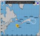
24.2N -47.3W
Wind: 35MPH
Pres: 1010mb
Moving:
Present movement...sw or 225 degrees at 12 mph...19 km/h
Click for Storm Spotlight
34.6N -45.5W
Wind: 40MPH
Pres: 1004mb
Moving:
Present movement...se or 125 degrees at 12 mph...19 km/h
Click for Storm Spotlight
HypeScale:
4.00
0510
Communication
Storm Data
Content
Follow & Connect


News Talkback >> 2007 Storm Forum

cieldumort
Moderator


Reged:
Posts: 2893
Loc: Austin, Tx
Re: Front and LLC Collision Course
      Fri Oct 19 2007 07:06 PM

Optical illusion. No surface circulation (reflection) of any significance exists under or near the ULL. Low clouds and surface winds are still blowing out of the southeast/south. ULL might enhance shower/storm activity along the front.

Post Extras Print Post   Remind Me!     Notify Moderator


Entire topic
Subject Posted by Posted on
* Front and LLC Collision Course srquirrely Fri Oct 19 2007 07:06 PM
. * * Re: Front and LLC Collision Course cieldumort   Fri Oct 19 2007 07:06 PM

Extra information
0 registered and 0 anonymous users are browsing this forum.

Moderator:  MikeC, Ed Dunham, danielw 


Forum Permissions
      You cannot start new topics
      You cannot reply to topics
      HTML is disabled
      UBBCode is enabled

Rating:
Thread views: 6723

Rate this thread

Jump to