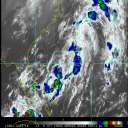
Current Radar or Satellite Image

Flhurricane.com - Central Florida Hurricane Center - Tracking Storms since 199531 Years of Hurricanes Without the Hype - Since 1995


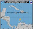
93C in the Central Pacific is now PTC ONE. NHC Advisories for Hawaii are being created. Elsewhere, Atlantic Invest 93L is now Tropical Storm Cristobal, out at sea.
Days since last Hurricane Landfall — US Any: 671 (Milton), US Major: 671 (Milton), FL Any: 671 (Milton), FL Major: 671 (Milton)
FlHurricane Atlantic Tropical Cyclone Tracking 🌀 Since 1995
36.7N -43.0W
Wind: 45MPH
Pres: 1008mb
Moving:
Present movement...e or 90 degrees at 25 mph...41 km/h
Click for Storm Spotlight
Invest 92LClick for Invest Information from CIMSS
HypeScale:
2.00
0510
Communication
Storm Data
Content
Follow & Connect


Off-Topic >> Everything and Nothing

Robert
Weather Analyst


Reged:
Posts: 371
Loc: Southeast, FL
Surfer insite
      Mon Jul 07 2008 06:25 PM

Hello Evryone its been some time scince i have came to this sight sry its been so long. I guess there has been lack of inthusiam with repeated eyewalls running over my house a coupe years ago, But anyway i wanted to share this website with you all. I use it for surfing year round and find thier wave hieght forcast are very accurete yet further its a meterological input on why the waves are gonaa break the way they are forcast. It is extremely important for surfers to have accuret swell arrivals, sise, and direction over a week ahead of time if not more so that are boss's can understand why we cant work a paticular day or so a trip can be planed and money spent to get to those waves. where ever they may be headed.

Here is math problem think tank if you will.

{1man} Hurricanes for example produce very litle fetch (Fetch = Distance of wind traveld over water in a straight line)
The longer the fetch, and the stronger the winds are = bigger waves. {1women} WAIT if hurricanes produce litle fetch this math problem doesent work. {1man} Correct but theres more! hurricanes that travel in a straight line for a long period of time can produce traveling fetch or virtuel fetch , When the fetch travels directly at a beach at just the right speed such that the swell it generates over multiple 12 hour intervals arrives a nearly the same time for a given frequency (period). That is if the swell from a storm on say Saturday a 5 AM, 5 PM and Sunday 5 AM all is expected to arrive at location X on Tuesday at noon, then we say the storm produced virtual fetch or traveling fetch. That also explianis why waves are only big in front of the storm and not the sides.
Somtime strong high presures that produce wind over 25knts can produce swell. high pressure usualy will only create local wind swell or chop. If a hurricane combines its winds with a high pressure it cause a gradient wich can produce huge swells. So all that being said Here is the website to the surf forcast i use It updates evry 3 days and + they have their own atmospheric wave model that takes in to acount, sea level elevation, atmospheric initlization, and also ground elevation so as to predict bend and eddys in wind direction around the coast and open ocean.


Storm Surf


Edited by Robert (Mon Jul 07 2008 06:26 PM)

Post Extras Print Post   Remind Me!     Notify Moderator


Entire topic
Subject Posted by Posted on
* Surfer insite Robert Mon Jul 07 2008 06:25 PM

Extra information
0 registered and 5 anonymous users are browsing this forum.

Moderator:  CFHC, Colleen A., danielw, RedingtonBeachGuy, Bloodstar, tpratch, cieldumort 


Forum Permissions
      You cannot start new topics
      You cannot reply to topics
      HTML is disabled
      UBBCode is enabled

Rating:
Thread views: 2645

Rate this thread

Jump to