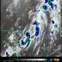
Current Radar or Satellite Image

Flhurricane.com - Central Florida Hurricane Center - Tracking Storms since 199531 Years of Hurricanes Without the Hype - Since 1995


Atlantic is quiet again.
Days since last Hurricane Landfall — US Any: 666 (Milton), US Major: 666 (Milton), FL Any: 666 (Milton), FL Major: 666 (Milton)
FlHurricane Atlantic Tropical Cyclone Tracking 🌀 Since 1995
None
HypeScale:
0.25
0510
Communication
Storm Data
Content
Follow & Connect


News Talkback >> 2008 Forecast Lounge

weathernet
Storm Tracker


Reged:
Posts: 296
Loc: Elsewhere
Re: GOM 91L
      Sun Aug 03 2008 03:23 PM

Latest model data as of the moment shows recon coming in with some wind reports ( up to 37knots ), which would support Tropical Storm force. Of course, one need apply various factors including actual winds speeds at the surface, probably at least a net 20% less than measured. Recon looks to be close to closing off a center and latest SHIPS model forecast initiates the system at 30knots.

I think we are now only within 90 minutes of a depression being made official. If so, Watches ( at minimum ) would soon be hoisted for parts of the Texas and Louisiana coastlines.

Post Extras Print Post   Remind Me!     Notify Moderator


Entire topic
Subject Posted by Posted on
* Edouard Lounge Beaumont, TX Sun Aug 03 2008 03:23 PM
. * * Re: GOM 91L weathernet   Sun Aug 03 2008 03:23 PM
. * * Re: GOM 91L weathernet   Sun Aug 03 2008 02:34 PM

Extra information
0 registered and 5 anonymous users are browsing this forum.

Moderator:  MikeC, Ed Dunham, danielw 


Forum Permissions
      You cannot start new topics
      You cannot reply to topics
      HTML is disabled
      UBBCode is enabled

Rating:
Thread views: 5736

Rate this thread

Jump to