Current Radar or Satellite Image

Flhurricane.com - Central Florida Hurricane Center - Tracking Storms since 199531 Years of Hurricanes Without the Hype - Since 1995


Nothing on the horizon for Atlantic development at the start of July.
Days since last Hurricane Landfall — US Any: 636 (Milton), US Major: 636 (Milton), FL Any: 636 (Milton), FL Major: 636 (Milton)
FlHurricane Atlantic Tropical Cyclone Tracking 🌀 Since 1995
None
HypeScale:
0.01
0510
Communication
Storm Data
Content
Follow & Connect


Archives 2010s >> 2010 Forecast Lounge

danielwAdministrator
Moderator


Reged:
Posts: 3527
Loc: Hattiesburg,MS (31.3N 89.3W)
Re: Week of 15 Aug 2010 - New Development
      Sat Aug 14 2010 05:02 PM

EXTENDED FORECAST DISCUSSION
NWS HYDROMETEOROLOGICAL PREDICTION CENTER CAMP SPRINGS MD
150 PM EDT SAT AUG 14 2010

VALID 12Z TUE AUG 17 2010 - 12Z SAT AUG 21 2010
(excerpt of Discussion~danielw)

WELL EASTWARD A INCREASING FAVORABLE MJO/VELOCITY POTENTIAL
ANOMALIES AND ACTUAL MODEL RUNS OF GFS/CMC/ECMWF ARE SHOWING
DEVELOPMENT OF CAPE VERDE/EAST ATLANTIC TROPICAL SYSTEMS MID TO
LATE FORECAST PERIOD AND BEYOND. GOOD GFS ENS AGREEMENT.
CLIMATOLOGICALLY RIGHT ON TIME.

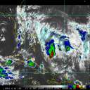
August 14,2010 at 2000Z


Copyright 2010 © EUMETSAT. All rights reserved

Edited by danielw (Sat Aug 14 2010 05:12 PM)

Post Extras Print Post   Remind Me!     Notify Moderator


Entire topic
Subject Posted by Posted on
* Week of 15 Aug 2010 - New Development berrywr Sat Aug 14 2010 05:02 PM
. * * Re: Week of 15 Aug 2010 - New Development WesnWylie   Fri Aug 13 2010 12:22 PM
. * * Re: Week of 15 Aug 2010 - New Development danielwAdministrator   Sat Aug 14 2010 05:02 PM
. * * Re: Week of 15 Aug 2010 - New Development lonelymike   Thu Aug 12 2010 05:29 PM

Extra information
0 registered and 1 anonymous users are browsing this forum.

Moderator:  


Forum Permissions
      You cannot start new topics
      You cannot reply to topics
      HTML is disabled
      UBBCode is enabled

Rating:
Thread views: 4872

Rate this thread

Jump to