Current Radar or Satellite Image

Flhurricane.com - Central Florida Hurricane Center - Tracking Storms since 199531 Years of Hurricanes Without the Hype - Since 1995


STRONG MID-ATLANTIC COASTAL HYBRID THIS WEEKEND. ELSEWHERE, TROPICAL STORM WARNING & HURRICANE WATCH FOR THE BIG ISLAND OF HAWAII (NOLO).

Days since last Hurricane Landfall — US Any: 716 (Milton), US Major: 716 (Milton), FL Any: 716 (Milton), FL Major: 716 (Milton)
FlHurricane Atlantic Tropical Cyclone Tracking 🌀 Since 1995
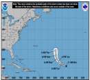
29.8N -43.9W
Wind: 35MPH
Pres: 1009mb
Moving:
Present movement...s or 180 degrees at 2 mph...4 km/h
Click for Storm Spotlight
18.8N -23.0W
Wind: 40MPH
Pres: 1005mb
Moving:
Present movement...nnw or 345 degrees at 10 mph...17 km/h
Click for Storm Spotlight
HypeScale:
5.00
0510
Communication
Storm Data
Content
Follow & Connect


General Discussion >> Hurricane Ask/Tell

Ed in Va
Weather Master


Reged:
Posts: 489
Cape Hatteras
      Fri Sep 03 2010 10:29 AM

This is not the first near-miss for Hatteras. Is there something about the wind currents there or some other phenomenom that naturally moves storms to the northeast at that point?

(Post moved to the appropriate Forum.)

--------------------
Survived Carol and Edna '54 in Maine. Guess this kind of dates me!

Edited by Ed Dunham (Fri Sep 03 2010 11:08 AM)

Post Extras Print Post   Remind Me!     Notify Moderator


Entire topic
Subject Posted by Posted on
* Cape Hatteras Ed in Va Fri Sep 03 2010 10:29 AM

Extra information
0 registered and 0 anonymous users are browsing this forum.

Moderator:  CFHC, Ed Dunham, Colleen A., danielw, Clark, RedingtonBeachGuy, Bloodstar, tpratch, typhoon_tip, cieldumort 


Forum Permissions
      You cannot start new topics
      You cannot reply to topics
      HTML is disabled
      UBBCode is enabled

Rating:
Thread views: 4453

Rate this thread

Jump to