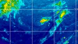
Current Radar or Satellite Image

Flhurricane.com - Central Florida Hurricane Center - Tracking Storms since 199531 Years of Hurricanes Without the Hype - Since 1995


Frontal complex continues tracking towards and into the southeast and east coasts but development into a tropical storm unlikely.
Days since last Hurricane Landfall — US Any: 43 (Isaias), US Major: 773 (Milton), FL Any: 43 (Isaias), FL Major: 773 (Milton)
FlHurricane Atlantic Tropical Cyclone Tracking 🌀 Since 1995
None
HypeScale:
0.05
0510
Communication
Storm Data
Content
Follow & Connect


Archives 2010s >> 2010 Forecast Lounge

ftlaudbob
Storm Chaser


Reged:
Posts: 829
Loc: Valladolid,Mx
Re: Invest 92L Forecast Lounge
      Fri Sep 10 2010 06:17 PM

Quote:

What is the very latest on 92L? Does it look like it will develope and be a threat to the gulf of mexico.


I think 92L will develop,NHC gives it a 50/50 chance to happen within 48 hours.As far as the path it is to early to tell,but my guess would be somewhere close to the Yucatan.

--------------------

Survived: 10 hurricanes in Rhode Island,Florida and the Yucatan of Mexico .


Post Extras Print Post   Remind Me!     Notify Moderator


Entire topic
Subject Posted by Posted on
* Invest 92L Forecast Lounge Rob Moser Fri Sep 10 2010 06:17 PM
. * * Re: Invest 92L Forecast Lounge WesnWylie   Thu Sep 09 2010 09:20 PM
. * * Re: Invest 92L Forecast Lounge Jasonch   Fri Sep 10 2010 05:38 PM
. * * Re: Invest 92L Forecast Lounge ftlaudbob   Fri Sep 10 2010 06:17 PM

Extra information
0 registered and 0 anonymous users are browsing this forum.

Moderator:  MikeC, Ed Dunham, danielw 


Forum Permissions
      You cannot start new topics
      You cannot reply to topics
      HTML is disabled
      UBBCode is enabled

Rating:
Thread views: 6218

Rate this thread

Jump to