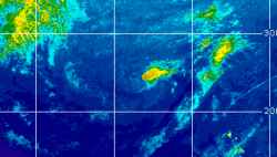
Current Radar or Satellite Image

Flhurricane.com - Central Florida Hurricane Center - Tracking Storms since 199531 Years of Hurricanes Without the Hype - Since 1995


Non-tropical Invest 94L well south of Bermuda slight odds of being named. EPAC TROF now extending across Central America into NW Caribbean.
Days since last Hurricane Landfall — US Any: 33 (Isaias), US Major: 763 (Milton), FL Any: 33 (Isaias), FL Major: 763 (Milton)
FlHurricane Atlantic Tropical Cyclone Tracking 🌀 Since 1995
HypeScale:
1.20
0510
Communication
Storm Data
Content
Follow & Connect


Archives 2010s >> 2010 Forecast Lounge

BryanG
Registered User


Reged:
Posts: 6
Loc: North of Tampa, FL
Re: 95LTrack & Intensity Forecast
      Thu Sep 23 2010 12:06 PM

Thanks Ed ... I did pull it out in June, but that was a long time ago

I love what you guys do here, keep up the good work!

Post Extras Print Post   Remind Me!     Notify Moderator


Entire topic
Subject Posted by Posted on
* 95LTrack & Intensity Forecast weathernet Thu Sep 23 2010 12:06 PM
. * * Re: 95LTrack & Intensity Forecast BryanG   Thu Sep 23 2010 11:08 AM
. * * Re: 95LTrack & Intensity Forecast Ed DunhamAdministrator   Thu Sep 23 2010 11:25 AM
. * * Re: 95LTrack & Intensity Forecast BryanG   Thu Sep 23 2010 12:06 PM

Extra information
0 registered and 0 anonymous users are browsing this forum.

Moderator:  MikeC, Ed Dunham, danielw 


Forum Permissions
      You cannot start new topics
      You cannot reply to topics
      HTML is disabled
      UBBCode is enabled

Rating:
Thread views: 8643

Rate this thread

Jump to