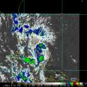
Current Radar or Satellite Image

Flhurricane.com - Central Florida Hurricane Center - Tracking Storms since 199531 Years of Hurricanes Without the Hype - Since 1995


STRONG MID-ATLANTIC COASTAL HYBRID THIS WEEKEND INTO EARLY NEXT WEEK. NOLO HEADS AWAY FROM BIG ISLAND OF HAWAII.

Days since last Hurricane Landfall — US Any: 717 (Milton), US Major: 717 (Milton), FL Any: 717 (Milton), FL Major: 717 (Milton)
FlHurricane Atlantic Tropical Cyclone Tracking 🌀 Since 1995
28.9N -44.0W
Wind: 35MPH
Pres: 1011mb
Moving:
Present movement...s or 180 degrees at 5 mph...7 km/h
Click for Storm Spotlight
Invest 07LClick for Invest Information from CIMSS
HypeScale:
3.00
0510
Communication
Storm Data
Content
Follow & Connect


General Discussion >> The Tropics Today

watchinout
Verified CFHC User


Reged:
Posts: 17
Convection near Puerto Rico
      Sun Aug 28 2011 05:30 PM

Looks like a good bit of convection trying to come together just south of P.R. I imagine the atmosphere is'nt the best for a storm right now. But I do remember some of the models picking up on it late last week. What do the rest of you think?

(Off-topic post was moved from the 92L Forecast Lounge to a more appropriate Forum.)

Edited by Ed Dunham (Sun Aug 28 2011 05:57 PM)

Post Extras Print Post   Remind Me!     Notify Moderator


Entire topic
Subject Posted by Posted on
* Convection near Puerto Rico watchinout Sun Aug 28 2011 05:30 PM

Extra information
0 registered and 0 anonymous users are browsing this forum.

Moderator:  CFHC, MikeC, Ed Dunham, Colleen A., danielw, Clark, RedingtonBeachGuy, SkeetoBite, Bloodstar, tpratch, typhoon_tip, cieldumort 


Forum Permissions
      You cannot start new topics
      You cannot reply to topics
      HTML is disabled
      UBBCode is enabled

Rating:
Thread views: 3825

Rate this thread

Jump to