
Current Radar or Satellite Image

Flhurricane.com - Central Florida Hurricane Center - Tracking Storms since 199531 Years of Hurricanes Without the Hype - Since 1995


TROPICAL STORM MOKE LIKELY TO BRING HEAVY RAINFALL AND GUSTY WINDS TO PORTIONS OF THE HAWAIIAN ISLANDS THIS WEEKEND AND EARLY NEXT WEEK
Days since last Hurricane Landfall — US Any: 683 (Milton), US Major: 683 (Milton), FL Any: 683 (Milton), FL Major: 683 (Milton)
FlHurricane Atlantic Tropical Cyclone Tracking 🌀 Since 1995
HypeScale:
2.25
0510
Communication
Storm Data
Content
Follow & Connect


Archives 2010s >> 2012 Forecast Lounge

LoisCane
Veteran Storm Chaser


Reged:
Posts: 1238
Loc: South Florida
Re: Invest 97L Forecast Lounge
      Sat Jun 30 2012 11:25 PM

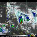
The Upper Level Low appears to have done the wave in.. more than the SAL I believe.

http://rammb.cira.colostate.edu/ramsdis/online/loop_640.asp?product=tropical_ge_14km_wv

Appearances can be deceiving but looks like resurrection of this wave would be ... hard to believe.

Saving my final thoughts for tomorrow to see if it flares up at all later tonight.

--------------------
http://hurricaneharbor.blogspot.com/

Post Extras Print Post   Remind Me!     Notify Moderator


Entire topic
Subject Posted by Posted on
* Invest 97L Forecast Lounge cieldumort Sat Jun 30 2012 11:25 PM
. * * Re: Invest 97L Forecast Lounge Joeyfl   Sat Jun 30 2012 01:04 PM
. * * Re: Invest 97L Forecast Lounge LoisCane   Sat Jun 30 2012 11:25 PM

Extra information
0 registered and 0 anonymous users are browsing this forum.

Moderator:  MikeC, Ed Dunham, danielw 


Forum Permissions
      You cannot start new topics
      You cannot reply to topics
      HTML is disabled
      UBBCode is enabled

Rating:
Thread views: 4912

Rate this thread

Jump to